
ABoVE: Synthesis of Burned and Unburned Forest Site Data, AK and Canada, 1983-2016
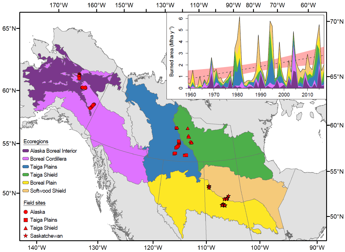
This dataset from the Arctic-Boreal Vulnerability Experiment (ABoVE) is a synthesis of field plot characterization data that includes derived above and below-ground combusted carbon, and acquired Fire Weather Index (FWI) System components for burned boreal forest sites across Alaska and Canada from 1983-2016. Data are from 1,019 burned and 152 unburned sites. The field studies span six ecoregions in the western North American boreal forest and capture broad gradients in pre-fire conditions of tree productivity, stand age, and ecosystem carbon storage. Meteorological controls are represented by day of burn (DOB) and FWI System indices. Compiled plot-level characterization data include stand age, disturbance history, tree density, and tree biophysical measurements for calculation of the above and below-ground biomass/carbon pools, pre-fire and residual post-fire soil organic layer (SOL) depths and estimates of combustion of tree structural classes. The total carbon combusted, the proportion of pre-fire carbon combusted, and the proportion of total carbon combusted were calculated from estimates of combusted above and below ground carbon pools and SOL losses. Site measured slope and aspect and an assigned moisture class based on topography are provided. Data for soil characteristics are included in a separate file.
ABoVE is a NASA Terrestrial Ecology Program field campaign being conducted in Alaska and western Canada, for 8 to 10 years, starting in 2015. Research for ABoVE links field-based, process-level studies with geospatial data products derived from airborne and satellite sensors, providing a foundation for improving the analysis, and modeling capabilities needed to understand and predict ecosystem responses to, and societal implications of, climate change in the Arctic and Boreal regions. See all ORNL DAAC data from ABoVE.
Data Citation: Walker, X.J., J.L. Baltzer, L.L. Bourgeau-Chavez, N.J. Day, W.J. De groot, C. Dieleman, E.E. Hoy, J.F. Johnstone, E.S. Kane, M.A. Parisien, S. Potter, B.M. Rogers, M.R. Turetsky, S. Veraverbeke, E. Whitman, and M.C. Mack. 2019. ABoVE: Synthesis of Burned and Unburned Forest Site Data, AK and Canada, 1983-2016. ORNL DAAC, Oak Ridge, Tennessee, USA. https://doi.org/10.3334/ORNLDAAC/1744