
Ocean Surface pCO2 and Air-Sea CO2 Flux in the Northern Gulf of Mexico, 2006-2010
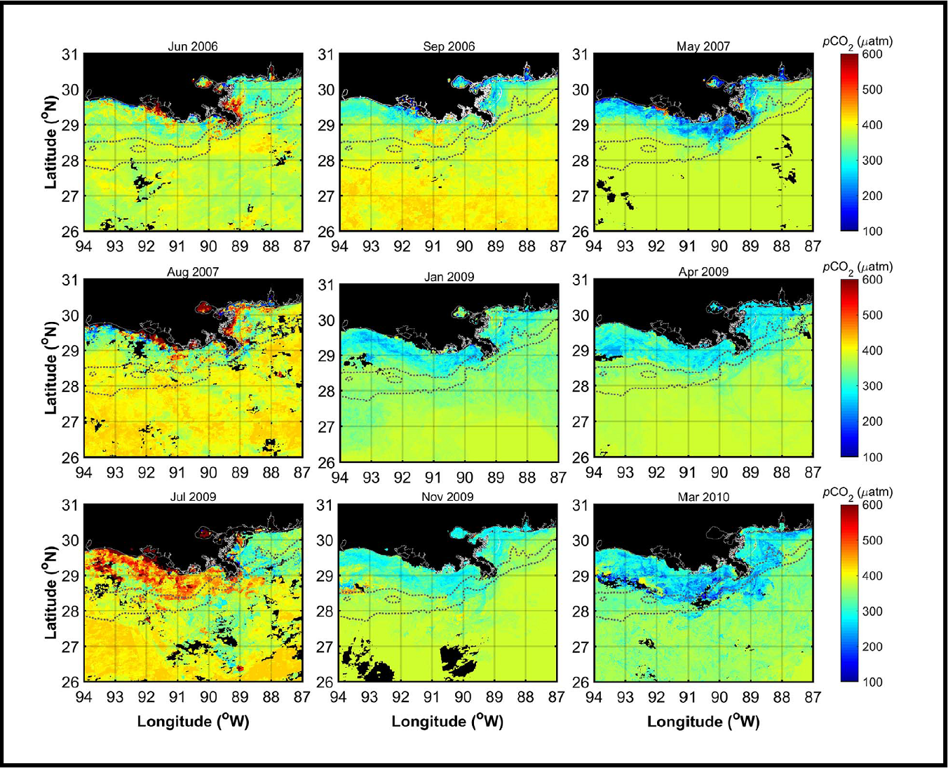
This dataset from the Carbon Monitoring System (CMS) provides 1 km gridded monthly estimates of surface ocean partial pressure of CO2 (pCO2) and air-sea flux of CO2 (CO2 flux) for the northern Gulf of Mexico for the period 2006 through 2010. Estimates of pCO2 were derived from MODIS/Aqua satellite imagery in combination with ship-based observations. Estimates of CO2 flux were derived from estimates of seawater pCO2, wind fields, and atmospheric pCO2. Satellite approaches for estimation of pCO2 and air-sea flux of CO2 in coastal regions offer the potential to reduce uncertainties in coastal carbon budgets and improve understanding of spatial and temporal patterns and the factors influencing them
The CMS is designed to make significant contributions in characterizing, quantifying, understanding, and predicting the evolution of global carbon sources and sinks through improved monitoring of carbon stocks and fluxes. See all ORNL DAAC data from the CMS.
Data Citation: Lohrenz, S.E., W.J. Cai, S. Chakraborty, R. He, and H. Tian. 2019. Ocean Surface pCO2 and Air-Sea CO2 Flux in the Northern Gulf of Mexico, 2006-2010. ORNL DAAC, Oak Ridge, Tennessee, USA. https://doi.org/10.3334/ORNLDAAC/1668
Data Center: ORNL DAAC
Sponsor: EOSDIS
