Ecosystem Functional Type Distribution Map for Mexico, 2001-2014
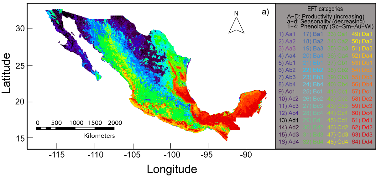
This dataset from the NASA Carbon Monitoring System (CMS) program provides a map of the distribution of ecosystem functional types (EFTs) at 0.05 degree resolution across Mexico for 2001 to 2014. Sixty-four EFTs were derived from the metrics of a 2001-2014 time-series of satellite images of the Enhanced Vegetation Index (EVI) from the Moderate Resolution Imaging Spectroradiometer (MODIS) product MOD13C2. EFT diversity was calculated as the modal (most repeated) EFT for each pixel. Also included are maps of the distributions of synthetic ecoregions (seven and 28 ecoregions) at 0.05 degree resolution and estimates of the spatial relationship (i.e., spatial representativeness) between actual and proposed environmental monitoring sites and ecosystem processes.
CMS is designed to make significant contributions in characterizing, quantifying, understanding, and predicting the evolution of global carbon sources and sinks through improved monitoring of carbon stocks and fluxes. See all ORNL DAAC data from CMS.
Data Citation: Villarreal, S., D. Alcaraz-segura, M. Guevara, and R. Vargas. 2019. Ecosystem Functional Type Distribution Map for Mexico, 2001-2014. ORNL DAAC, Oak Ridge, Tennessee, USA. https://doi.org/10.3334/ORNLDAAC/1693
Data Center: ORNL DAAC
Sponsor: EOSDIS


