
Ecosystem Functional Type Distribution Map for the Conterminous USA, 2001-2014
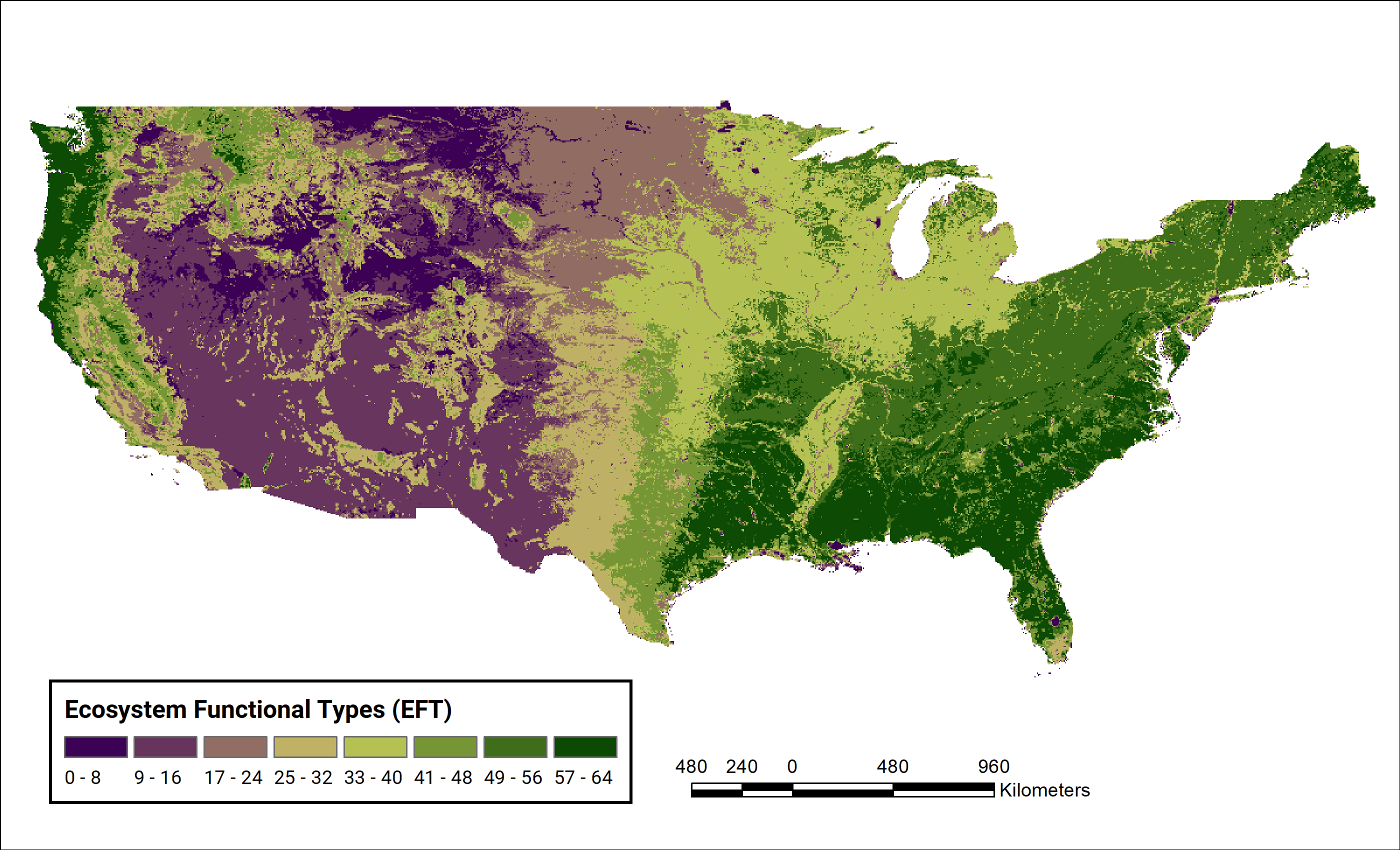
This new dataset from the Carbon Monitoring System (CMS) provides maps of the distribution of ecosystem functional types (EFTs) and the interannual variability of EFTs at 0.05 degree resolution across the conterminous United States (CONUS) for 2001 to 2014. EFTs are groupings of ecosystems based on their similar ecosystem functioning that are used to represent the spatial patterns and temporal variability of key ecosystem functional traits without prior knowledge of vegetation type or canopy architecture. Sixty-four EFTs were derived from the metrics of a 2001-2014 time-series of satellite images. Also included in this dataset are estimates of the spatial relationship between environmental monitoring sites and EFT measures.
The CMS is designed to make significant contributions in characterizing, quantifying, understanding, and predicting the evolution of global carbon sources and sinks through improved monitoring of carbon stocks and fluxes. See all ORNL DAAC datasets from the Carbon Monitoring System.
Data Citation: Villarreal, S., R. Vargas, and D. Alcaraz-segura. 2019. Ecosystem Functional Type Distribution Map for the Conterminous USA, 2001-2014. ORNL DAAC, Oak Ridge, Tennessee, USA. https://doi.org/10.3334/ORNLDAAC/1659
