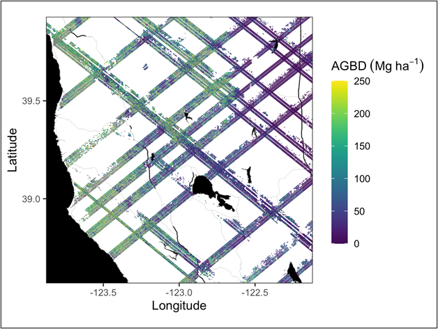
The GEDI Science Team has confirmed that GEDI L4A, Version 2 files are affected by an issue that results in incorrect estimates of the aboveground biomass density (AGBD) estimates generated using algorithm setting group 10. AGBD estimates based on other algorithm setting groups are not affected. An updated data product is being made available as quickly as possible. Users should not use the AGBD estimates for the cases where the selected algorithm setting group is 10, which affects about 3% of the good quality footprints.
We have emailed users who have downloaded this data product. We will post an update here when the updated data product is available.
Citation: Dubayah, R.O., J. Armston, J.R. Kellner, L. Duncanson, S.P. Healey, P.L. Patterson, S. Hancock, H. Tang, J. Bruening, M.A. Hofton, J.B. Blair, and S.B. Luthcke. 2021. GEDI L4A Footprint Level Aboveground Biomass Density, Version 2. ORNL DAAC, Oak Ridge, Tennessee, USA. https://doi.org/10.3334/ORNLDAAC/1986

