
ABoVE: High Resolution Cloud-Free Snow Cover Extent and Snow Depth, Alaska, 2001-2017
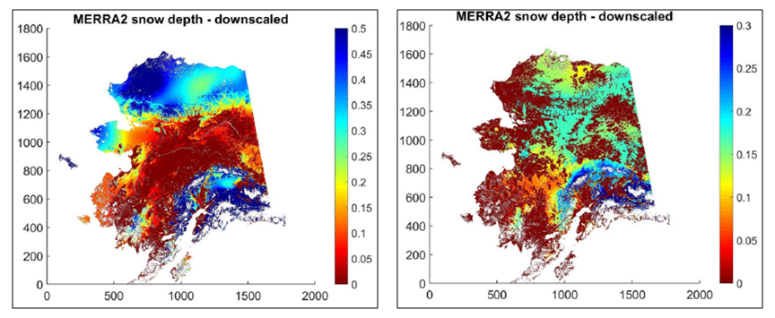
This dataset from the Arctic-Boreal Vulnerability Experiment (ABoVE) provides estimates of maximum snow cover extent (SCE) and snow depth for each 8-day composite from 2001 to 2017 at a 1 km resolution. The study area covers most of Alaska except for areas covered by perennial ice/snow or open water. For this dataset, snow depth from MERRA-2 (Modern-Era Retrospective Analysis for Research and Applications - Version 2) 0.5 degree data were interpolated to a finer 1 km spatial grid using derived cloud-free MODIS SCE (MOD10A2) data which were incorporated to better account for the influence of local topography on snow distribution patterns. This dataset for the Arctic region is significant because it has high (≤1 km) spatial resolution and high (~weekly) temporal fidelity.
ABoVE is a NASA Terrestrial Ecology Program field campaign being conducted in Alaska and western Canada, for 8 to 10 years, starting in 2015. Research for ABoVE links field-based, process-level studies with geospatial data products derived from airborne and satellite sensors, providing a foundation for improving the analysis, and modeling capabilities needed to understand and predict ecosystem responses to, and societal implications of, climate change in the Arctic and Boreal regions. See all ORNL DAAC data from ABoVE.
Data Citation: Yi, Y., J. Kimball, and C.E. Miller. 2020. ABoVE: High Resolution Cloud-Free Snow Cover Extent and Snow Depth, Alaska, 2001-2017. ORNL DAAC, Oak Ridge, Tennessee, USA. https://doi.org/10.3334/ORNLDAAC/1757