
CMS: Mangrove Forest Cover Extent and Change across Major River Deltas, 2000-2016
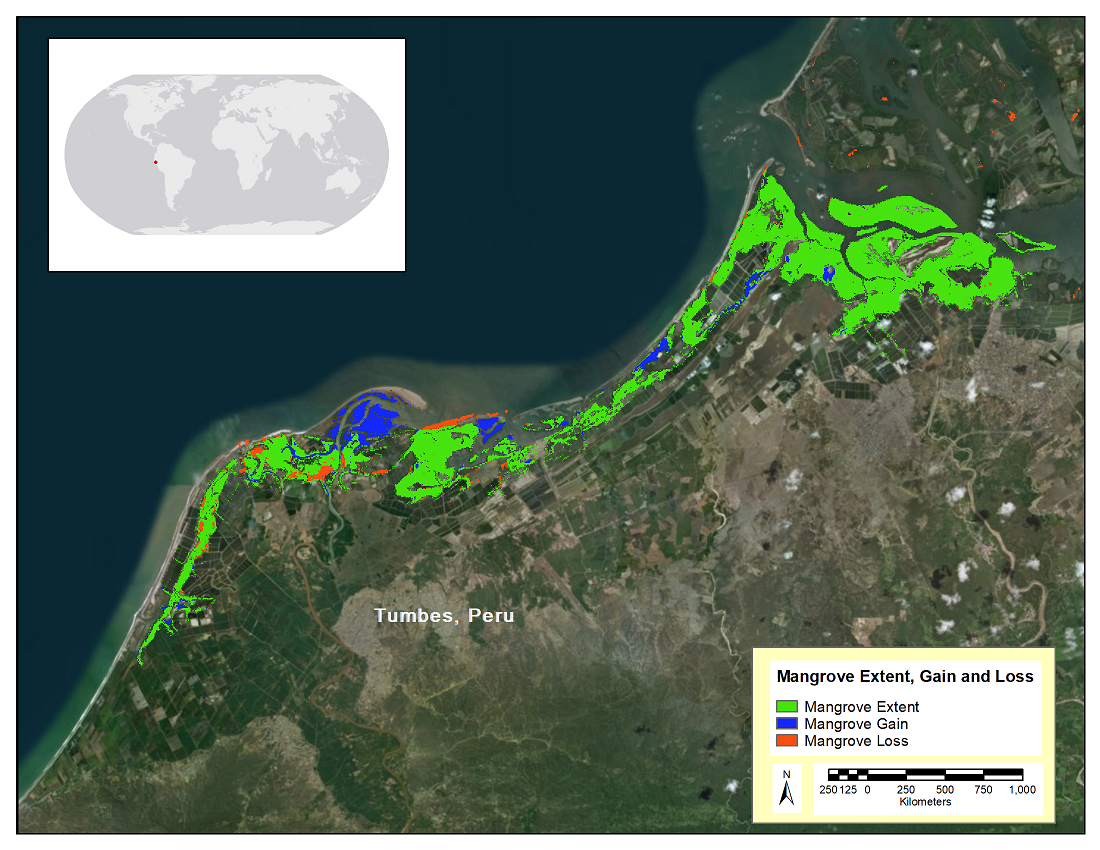
This dataset from the Carbon Monitoring System (CMS) provides estimates of mangrove extent for 2016, and mangrove change from 2000 to 2016, in major river delta regions of six countries: Gabon, Jamaica, Mozambique, Peru, Senegal, and Tanzania. For mangrove extent, a combination of Landsat 8 OLI, Sentinel-1 C-SAR, and Shuttle Radar Topography Mission (SRTM) elevation data were used to create country-wide maps of mangrove landcover extent at a 30 m resolution. Normalized Difference Vegetation Indices (NDVI) were calculated for every cloud- and shadow-free pixel in the Landsat 5 TM, Landsat 7 ETM+, and Landsat 8 OLI collection and used to create an NDVI anomaly from 2000 to 2016. Areas of change (loss or gain) occurred at the extremes of the cumulative anomalies.
The CMS is designed to make significant contributions in characterizing, quantifying, understanding, and predicting the evolution of global carbon sources and sinks through improved monitoring of carbon stocks and fluxes. See all ORNL DAAC data from the CMS.
Data Citation: Lagomasino, D., T. Fatoyinbo, S. Lee, E. Feliciano, C. Trettin, A. Shapiro, and M. Mwita. 2019. CMS: Mangrove Forest Cover Extent and Change across Major River Deltas, 2000-2016. ORNL DAAC, Oak Ridge, Tennessee, USA. https://doi.org/10.3334/ORNLDAAC/1670
Data Center: ORNL DAAC
Sponsor: EOSDIS
