
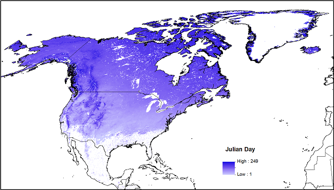
Snowmelt Timing Maps Derived from MODIS for North America, Version 2, 2001-2018
This dataset provides a new version of snowmelt timing maps (STMs), cloud interference maps, and a map of calculated snowmelt timing values for North America. The STMs are based on the Moderate Resolution Imaging Spectroradiometer (MODIS) standard 8-day composite snow-cover product MOD10A2 collection 6 for the period 2001-01-01 to 2018-12-31. The STMs were created by conducting a time-series analysis of the MOD10A2 snow maps to identify the DOY of snowmelt on a per-pixel basis. These data may be of interest to researchers investigating questions of phenology, hydrology, climatology, land management, recreation, and other areas.
Related Dataset: This dataset supersedes Version 1, derived from MODIS collection 5 data.
O'Leary III, D., D.K. Hall, M. Medler, R. Matthews, and A. Flower. 2017. Snowmelt Timing Maps Derived from MODIS for North America, 2001-2015. ORNL DAAC, Oak Ridge, Tennessee, USA. https://doi.org/10.3334/ORNLDAAC/1504
Data Citation: O'Leary III, D., D.K. Hall, M. Medler, R. Matthews, and A. Flower. 2019. Snowmelt Timing Maps Derived from MODIS for North America, Version 2, 2001-2018. ORNL DAAC, Oak Ridge, Tennessee, USA. https://doi.org/10.3334/ORNLDAAC/1712
Data Center: ORNL DAAC
Sponsor: EOSDIS
