ABoVE: Corrected MODIS MAIAC Reflectance at Tower Sites, Alaska and Canada, 2000-2016
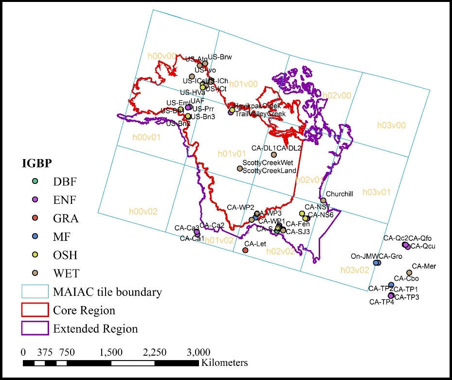
A new Arctic-Boreal Vulnerability Experiment (ABoVE) dataset provides angular corrections of MODIS Multi-Angle Implementation of Atmospheric Correction algorithm (MAIAC) surface reflectances by two methods at each of 62 flux tower sites across the ABoVE domain in Alaska and western Canada from 2000 to 2015/2016. Original MAIAC reflectance data were corrected to consistent view and illumination angles using two independent algorithms: the first based on the original BRDF (Bidirectional Reflectance Distribution Function) parameters provided by the MAIAC team, and the second based on a machine learning approach (random forests). The resulting tower site sub-daily timeseries of angular corrected surface reflectances are suitable for long-term studies on patterns, processes, and dynamics of surface phenomena. The flux tower sites are located within 10 different Terra and Aqua satellite tiles. The observation time, sun-view geometry, the cloud and land masks from MCD19A1, and International Geosphere-Biosphere Programme (IGBP) land cover class are also included.
ABoVE is a NASA Terrestrial Ecology Program field campaign conducted in Alaska and western Canada between 2016 and 2021. Research for ABoVE links field-based, process-level studies with geospatial data products derived from airborne and satellite sensors. See all ORNL DAAC data from ABoVE.
Data Citation: Yu, R., G. Hmimina, K.F. Huemmrich, D.P. Billesbach, A. Lyapustin, Y. Wang, and J.A. Gamon. 2019. ABoVE: Corrected MODIS MAIAC Reflectance at Tower Sites, Alaska and Canada, 2000-2016. ORNL DAAC, Oak Ridge, Tennessee, USA. https://doi.org/10.3334/ORNLDAAC/1700
Data Center: ORNL DAAC
Sponsor: EOSDIS


