
The ORNL DAAC recently released the following dataset by Barnes, N., et al. (2021):
Multispectral Imagery, NDVI, and Terrain Models, Big Trail Lake, Fairbanks, AK, 2019
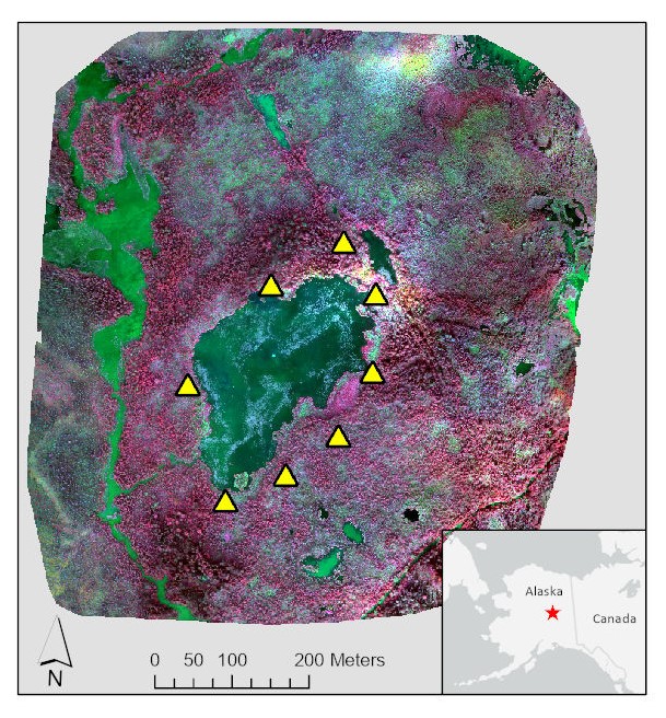
This dataset provides multispectral reflectance imagery (green, red, red edge, and near-infrared), normalized difference vegetation index (NDVI), and digital surface and terrain models for a 0.5 km2 area surrounding Big Trail Lake in the Goldstream Creek Valley, north of Fairbanks, Alaska. These high spatial resolution maps (13-cm x 13-cm) were captured by unmanned aerial vehicle (UAV) imagery collected on 2019-08-04. Raw images (n=908) were combined into mosaic layers that incorporated ground control points with centimeter accuracy. Vegetation, water body, and elevation estimates were generated and combined with in situ measurements of methane flux to improve upscaling models of greenhouse gas emissions.
Additional data about vegetation datasets and other relevant links can be found on the ORNL DAAC's Vegetation Science Theme.
Citation:
Barnes, N., H. Webb, M.K. Farina, S. Powell, and J.D. Watts. 2021. Multispectral Imagery, NDVI, and Terrain Models, Big Trail Lake, Fairbanks, AK, 2019. ORNL DAAC, Oak Ridge, Tennessee, USA. https://doi.org/10.3334/ORNLDAAC/1834