
The ORNL DAAC is excited for the much anticipated release of NASA's Global Ecosystems Dynamics Investigation (GEDI) data with Level-1 and Level-2 data currently available. Join us in registering for the NASA Earthdata Webinar presented by the Land Processes (LP) DAAC in conjunction with UMD GEDI Science Team Research Professor, Dr. Michelle Hofton.
Find and Use GEDI, You Will - Getting Started with Global Ecosystems Dynamics Investigation (GEDI) Lidar Data
When: Wednesday, June 24, 2:00 p.m. - 3:00 p.m. EST
Speakers:
Dr. Michelle Hofton, GEDI Science Team, Research Professor, UMD
Cole Krehbiel, Remote Sensing Scientist, NASA LP DAAC
Register Here: Adobe Connect
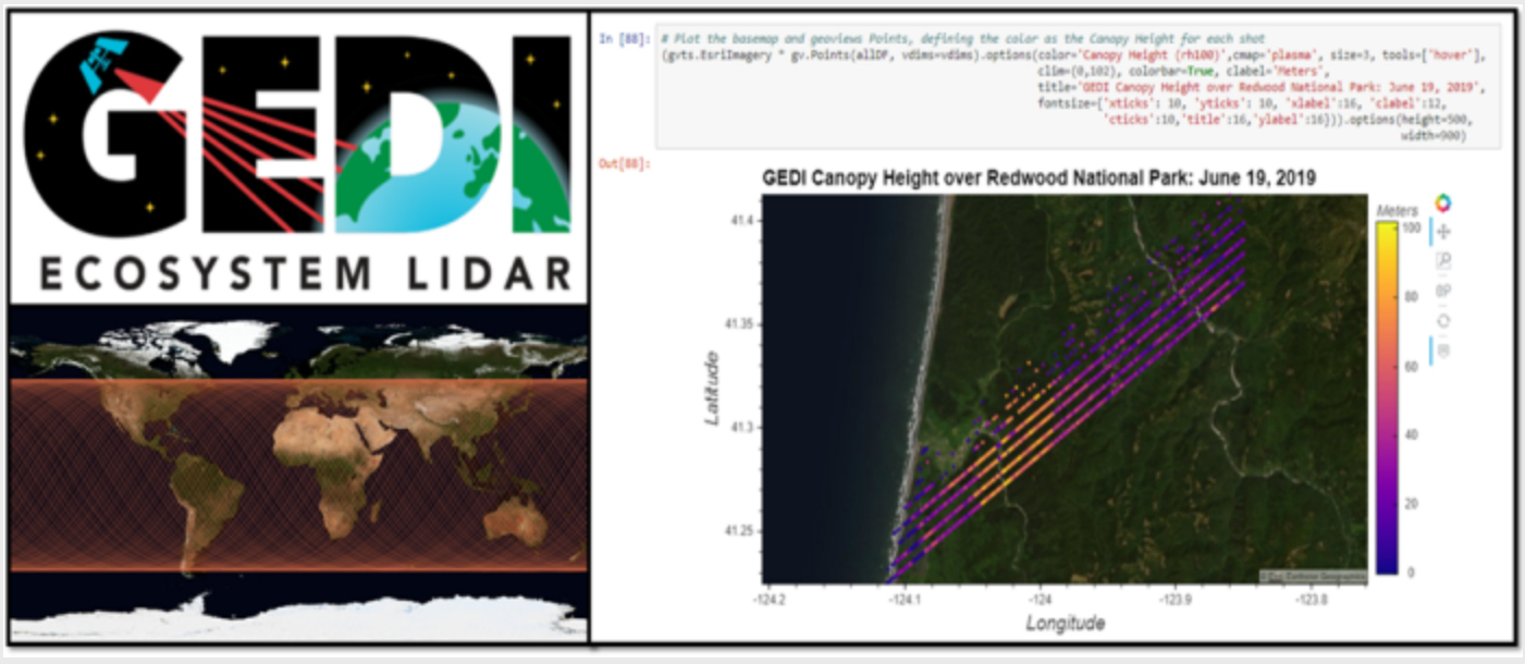
The Global Ecosystem Dynamics Investigation (GEDI) produces high-resolution laser ranging observations of the 3D structure of the Earth. GEDI’s precise measurements of forest canopy height, canopy vertical structure, and surface elevation greatly advance our ability to characterize important carbon and water cycling processes, biodiversity, and habitat. GEDI was funded as a NASA Earth Ventures Instrument (EVI) mission. It was launched to the International Space Station in December 2018 and became operational in March 2019.
Level-1 and Level-2 data from GEDI are available from the LP DAAC. Gridded Level-3 GEDI data will be available from the ORNL DAAC beginning in the summer of 2020, with Level-4 data to follow in early 2021.