Pre-Delta-X: Spectral Reflectance of Water Surface, Atchafalaya Basin, LA, USA, 2016
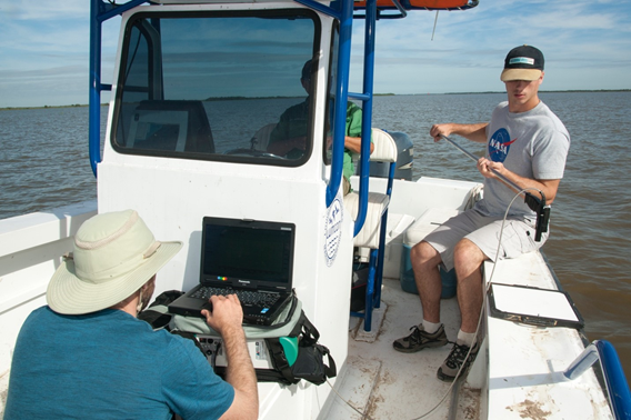
This dataset provides measurements of in situ remote-sensing reflectance (Rrs(λ); per steradian) of surface water across Atchafalaya Basin, southern coastal Louisiana, USA, within Mississippi River Delta (MRD) floodplain. The in situ spectral reflectance measurements were made during the Pre-Delta-X campaign in Fall 2016 (October 14–21). Hand-held spectrometer measurements were collected from a boat at 35 locations selected to represent a range of suspended sediment concentrations and properties from a variety of hydrodynamic and physical settings typically encountered across the Atchafalaya and Terrebonne basins. These 35 spectral reflectance measurements were collected at 24 unique sites that coincide with measurements of total suspended solids (TSS). The data serves two main purposes, to ground-truth the remote-sensing reflectance derived from NASA’s Airborne Visible-Infrared Imaging Spectrometer - Next Generation (AVIRIS-NG) instrument and to calibrate and validate algorithms for the retrieval of TSS from AVIRIS-NG.
The Delta-X mission is a NASA Earth Venture Suborbital-3 mission to study the Mississippi River Delta in the United States, which is growing and sinking in different areas. River deltas and their wetlands are drowning as a result of sea level rise and reduced sediment inputs. The Delta-X mission will determine which parts will survive and continue to grow, and which parts will be lost. Delta-X begins with airborne and in situ data acquisition and carries through data analysis, model integration, and validation to predict the extent and spatial patterns of future deltaic land loss or gain.
Other data from this mission can be found at the ORNL DAAC's Delta-X project page.
Data Citation: Jensen, D.J., T.M. Pavelsky, and C. Lion. 2020. Pre-Delta-X: Spectral Reflectance of Water Surface, Atchafalaya Basin, LA, USA, 2016. ORNL DAAC, Oak Ridge, Tennessee, USA. https://doi.org/10.3334/ORNLDAAC/1804

