
ABoVE: Passive Microwave-derived Annual Snowoff Date Maps, 1988-2016
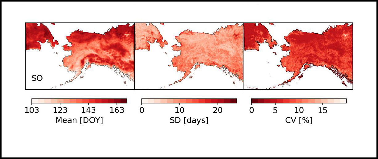
This dataset from the Arctic-Boreal Vulnerability Experiment (ABoVE) provides annual maps of the snowoff (SO) date from 1988-2016 across Alaska and parts of Far East Russia and northwest Canada at a resolution of 6.25 km. SO date is defined as the last day of persistent snow and was derived from the MEaSUREs Calibrated Enhanced-Resolution Passive Microwave (PMW) EASE-Grid Brightness Temperature (Tb) Earth System Data Record (ESDR) product. The spatial domain was intended to match MODIS Alaska Snow Metrics and extend its temporal fidelity beyond the MODIS era. SO date estimates were compared to snow depth measurements collected at SNOTEL stations across Alaska and to three SO datasets derived from MODIS, Landsat, and the Interactive Multisensor Snow and Ice Mapping System (IMS).
ABoVE is a NASA Terrestrial Ecology Program field campaign conducted in Alaska and western Canada between 2016 and 2021. Research for ABoVE links field-based, process-level studies with geospatial data products derived from airborne and satellite sensors, providing a foundation for improving the analysis, and modeling capabilities needed to understand and predict ecosystem responses to, and societal implications of, climate change in the Arctic and Boreal regions. See all ORNL DAAC data from ABoVE.
Data Citation: Pan, C.G., P.B. Kirchner, J. Du, and J.S. Kimball. 2019. ABoVE: Passive Microwave-derived Annual Snowoff Date Maps, 1988-2016. ORNL DAAC, Oak Ridge, Tennessee, USA. https://doi.org/10.3334/ORNLDAAC/1711
Data Center: ORNL DAAC
Sponsor: EOSDIS
