
Soil Organic Carbon Estimates and Uncertainty at 1-m Depth across Mexico, 1999-2009
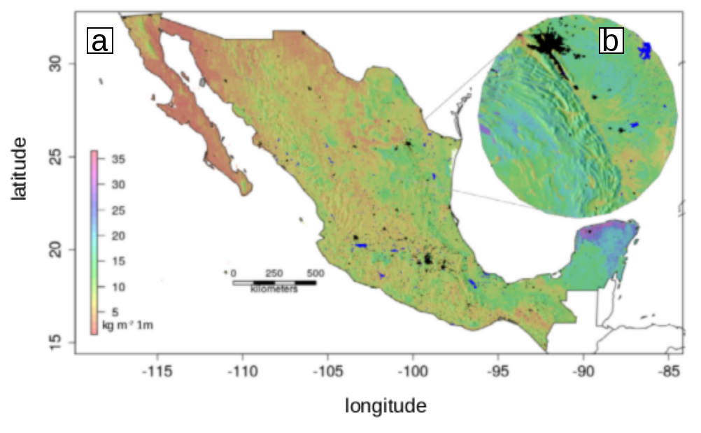
This dataset from the Carbon Monitoring System (CMS) provides an estimate of soil organic carbon (SOC) in the top one meter of soil across Mexico at a 90 m resolution for the period 1999-2009. Carbon estimates (kg/m2) are based on a field data collection of 2852 soil profiles by the National Institute for Statistics and Geography (INEGI). The profile data were used for the development of a predictive model along with a set of environmental covariates that were harmonized in a regular grid of 90 m2 across all Mexican states. The error associated with the predictive model estimates of SOC is provided. A summary of the total estimated SOC per state, statistical description of the modeled SOC data, and the number of pixels modeled for each state are also provided.
The CMS is designed to make significant contributions in characterizing, quantifying, understanding, and predicting the evolution of global carbon sources and sinks through improved monitoring of carbon stocks and fluxes. The system will use the full range of NASA satellite observations and modeling/analysis capabilities to establish the accuracy, quantitative uncertainties, and utility of products for supporting national and international policy, regulatory, and management activities. CMS will maintain a global emphasis while providing finer scale regional information, utilizing space-based and surface-based data. See all ORNL DAAC data from the CMS.
Data Citation: Guevara, M., and R. Vargas. 2020. Soil Organic Carbon Estimates and Uncertainty at 1-m Depth across Mexico, 1999-2009. ORNL DAAC, Oak Ridge, Tennessee, USA. https://doi.org/10.3334/ORNLDAAC/1754
Data Center: ORNL DAAC
Sponsor: EOSDIS
