
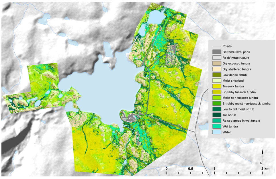
High-Resolution Vegetation Community Maps, Toolik Lake Area, Alaska, 2013-2015
A new Arctic-Boreal Vulnerability Experiment (ABoVE) dataset contains vegetation community maps at 20 cm resolution for three landscapes near the Toolik Lake research area in the northern foothills of the Brooks Range, Alaska, USA. The maps were built using a Random Forest modeling approach using predictor layers derived from airborne lidar data and high-resolution digital airborne imagery collected in 2013, and vegetation community training data collected from 800 reference field plots across the lidar footprints in 2014 and 2015. This information can serve as validation for coarser maps and as baseline data for vegetation monitoring and change detection.
Research for ABoVE links field-based, process-level studies with geospatial data products derived from airborne and satellite sensors, providing a foundation for improving the analysis, and modeling capabilities needed to understand and predict ecosystem responses to, and societal implications of, climate change in the Arctic and Boreal regions. See all ORNL DAAC data from NASA's ABoVE field campaign.
Data Citation: Greaves, H.E., J. Eitel, L. Vierling, N. Boelman, K. Griffin, T. Magney, and C. Prager. 2019. High-Resolution Vegetation Community Maps, Toolik Lake Area, Alaska, 2013-2015. ORNL DAAC, Oak Ridge, Tennessee, USA. https://doi.org/10.3334/ORNLDAAC/1690
Data Center: ORNL DAAC
Sponsor: EOSDIS
