
Gridded Estimates of Woody Cover and Biomass across Sub-Saharan Africa, 2000-2004
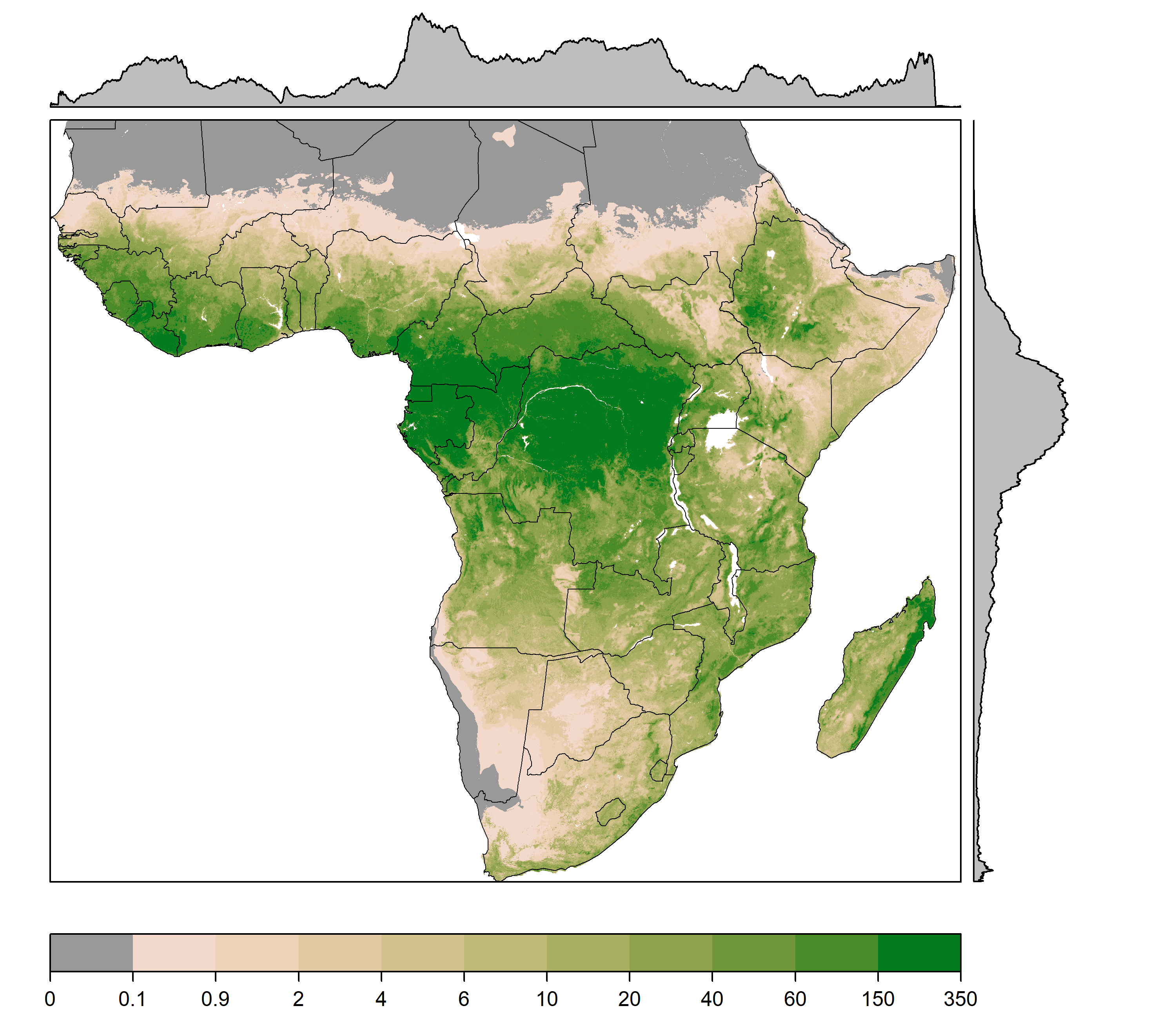
This dataset provides maps of woody (tree and shrub) cover and biomass across Sub-Saharan Africa at a resolution of 1 km averaged for the period 2000-2004. Canopy cover observations and remote-sensing data related to woody vegetation were used to predict woody cover across Africa. Predicted woody cover, canopy height, and tree allometry were used to estimate woody biomass for Sub-Saharan Africa. Canopy cover observations were assembled from field measurements and Google Earth imagery for under-sampled regions collected from 2000-2004. Remote-sensing data related to the structural attributes of woody vegetation were derived from MODIS optical data and Q-SCAT (Quick Scatterometer) microwave measurements. Canopy height estimates were derived from spaceborne lidar and tree allometry equations were retrieved from GlobAllomeTree.
Data Citation: Ross, C.W., N.P. Hanan, and L. Prihodko. 2020. Gridded Estimates of Woody Cover and Biomass across Sub-Saharan Africa, 2000-2004. ORNL DAAC, Oak Ridge, Tennessee, USA. https://doi.org/10.3334/ORNLDAAC/1777