
ABoVE: Landsat-derived Annual Dominant Land Cover Across ABoVE Core Domain, 1984-2014
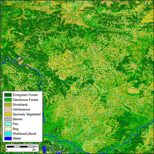
This dataset provides two 30 m resolution products of annual land cover classifications over the Arctic Boreal Vulnerability Experiment (ABoVE) core domain for each year of the period 1984 to 2014. The data are the annual dominant plant functional type that were derived from time series of Landsat surface reflectance and landcover training data mapped across the ABoVE domain using Random Forest modeling. One product has a 15-class land cover classification that breaks out forest and shrub types into several additional classes. The second product provides a 10-class approach. These data could help to quantify the loss, regrowth, and transitions between evergreen and deciduous tree species in the boreal forest biome at large spatial scales.
ABoVE is a NASA Terrestrial Ecology Program field campaign taking place in Alaska and western Canada between 2016 and 2021.ABoVE seeks a better understanding of the vulnerability and resilience of ecosystems and society to this changing environment. See all ORNL DAAC data from ABoVE.
Data Citation: Wang, J.A., D. Sulla-Menashe, C.E. Woodcock, O. Sonnentag, R.F. Keeling, and M.A. Friedl. 2019. ABoVE: Landsat-derived Annual Dominant Land Cover Across ABoVE Core Domain, 1984-2014. ORNL DAAC, Oak Ridge, Tennessee, USA. https://doi.org/10.3334/ORNLDAAC/1691
Data Center: ORNL DAAC
Sponsor: EOSDIS
