
ABoVE: Rain-on-Snow Frequency and Distribution during Cold Seasons, Alaska, 2003-2016
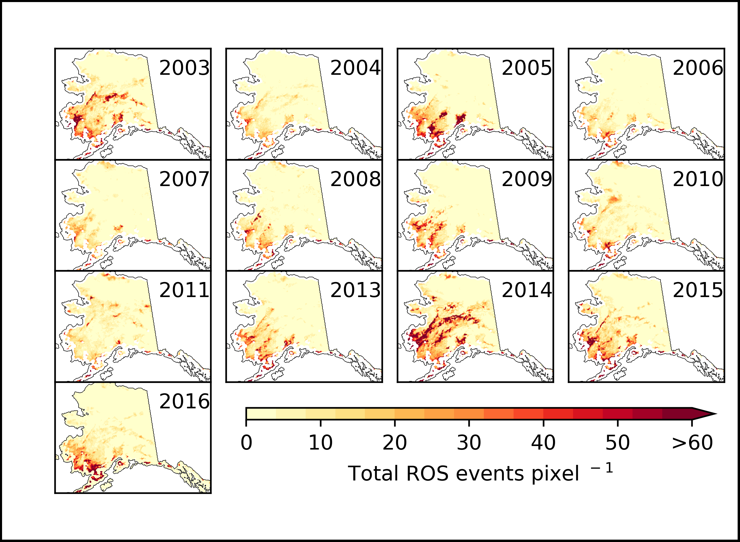
This dataset provides maps of rain-on-snow (ROS) events across Alaska for the months of November to March 2002-2011 and November to March 2012-2016, and annual water year summary maps for 2003-2011 and 2013-2016. ROS events were defined as changes in passive microwave detection in surface snow wetness and isothermal states induced by atmospheric processes often associated with winter rainfall. The data are summations of the number of days with ROS events per pixel at 6 km spatial resolution per month or per 5-month water year.
The Arctic-Boreal Vulnerability Experiment (ABoVE) is a NASA Terrestrial Ecology Program field campaign that will take place in Alaska and western Canada during 2016-2021. Research for ABoVE will link field-based, process-level studies with geospatial data products derived from airborne and satellite sensors, providing a foundation for improving the analysis, and modeling capabilities needed to understand and predict ecosystem responses and societal implications.
See all data from ABoVE.
Data Citation: Pan, C.G., P.B. Kirchner, J.S. Kimball, Y. Kim, and J. Du. 2018. ABoVE: Rain-on-Snow Frequency and Distribution during Cold Seasons, Alaska, 2003-2016. ORNL DAAC, Oak Ridge, Tennessee, USA. https://doi.org/10.3334/ORNLDAAC/1611
Data Center: ORNL DAAC
Sponsor: EOSDIS
