
ATom: Nucleation Mode Aerosol Size Spectrometer Calibration and Performance Data
This dataset provides extensive calibration and in-flight performance data for two nucleation mode aerosol size spectrometer (NMASS) instruments utilized in the NASA Atmospheric Tomography Mission (ATom) deployments 1 and 2.
Data Citation: Williamson, C., A. Kupc, J. Wilson, D.W. Gesler, M.J. Reeves, F. Erdesz, R. Mclaughlin, and C.A. Brock. 2018. ATom: Nucleation Mode Aerosol Size Spectrometer Calibration and Performance Data. ORNL DAAC, Oak Ridge, Tennessee, USA. https://doi.org/10.3334/ORNLDAAC/1607
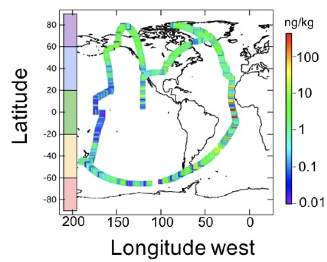
ATom: Black Carbon Mass Mixing Ratios from ATom-1 Flights
This dataset provides black carbon (BC) mass mixing ratios (in units of ng BC / kg air) measured during the ATom-1 campaign in July and August 2016. The associated latitude, longitude, altitude, and the timestamp of each measurement are included at ten seconds resolution.
Data Citation: Katich, J.M., J.P. Schwarz, K. Froyd, B. Weinzierl, M. Dollner, T.P. Bui, C.S. Chang, and J.M. Dean-Day. 2018. ATom: Black Carbon Mass Mixing Ratios from ATom-1 Flights. ORNL DAAC, Oak Ridge, Tennessee, USA. https://doi.org/10.3334/ORNLDAAC/1618
The Atmospheric Tomography Mission (ATom) is a NASA Earth Venture Suborbital-2 mission. All flights begin in California, fly north to the western Arctic, south to the South Pacific, east to the southern Atlantic, north to Greenland, and return to California across central North America.
See all data from the ATom mission.
Data Center: ORNL DAAC
Sponsor: NASA EODIS
