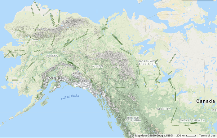
The ORNL DAAC recently released the following Arctic-Boreal Vulnerability Experiment (ABoVE) dataset by Shimada, J.G., et al. (2021):
ABoVE: L1 S-0 Polarimetric Data from UAVSAR P-band SAR, Alaska and Canada, 2017
This dataset provides Level 1 polarimetric radar backscattering coefficient, multi-look complex, polarimetrically calibrated, and georeferenced data products from the UAVSAR P-band SAR radar instrument flown onboard a NASA Gulfstream-III aircraft. These data were collected over 74 study sites across Alaska and western Canada. The radar instrument is a fully polarimetric P-band (ultra-high frequency) SAR. The flight campaigns took place periodically in May-August 2017. Each set of products was produced from a data take (i.e., acquisition) of the UAVSAR P-band SAR radar instrument, where one data take is equivalent to one flight line over a site. Two to four data takes were sought for each site, although for some sites as few as one or as many as six are provided. There were a total of 139 data takes over the 74 sites.
The ABoVE is a NASA Terrestrial Ecology Program field campaign being conducted in Alaska and western Canada, for 8 to 10 years, starting in 2015. Research for ABoVE links field-based, process-level studies with geospatial data products derived from airborne and satellite sensors, providing a foundation for improving the analysis, and modeling capabilities needed to understand and predict ecosystem responses to, and societal implications of, climate change in the Arctic and Boreal regions.
Additional data from ABoVE and other relevant links can be found on the ORNL DAAC's ABoVE Project Page.
Citation: Shimada, J.G., Y. Lou, S. Hensley, B.P. Hawkins, L. Harcke, D.M. Lagoy, T.R. Michel, R.J. Muellerschoen, S. Flores, N. Pinto, C. Rains, W.W. Tung, and Y. Zheng. 2021. ABoVE: L1 S-0 Polarimetric Data from UAVSAR P-band SAR, Alaska and Canada, 2017. ORNL DAAC, Oak Ridge, Tennessee, USA. https://doi.org/10.3334/ORNLDAAC/1800

