
ABoVE: Riverbank Erosion and Vegetation Changes, Yukon River Basin, Alaska, 1984-2017
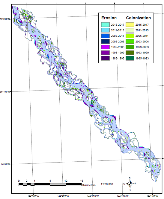
This dataset from the Arctic-Boreal Vulnerability Experiment (ABoVE) provides a time series of riverbank erosion and vegetation colonization changes along reaches of the Yukon River, the tributary Tanana and Nenana Rivers, and the tributary Chandalar River in interior Alaska over the period 1984-2017. The change data were derived from selected 30 m images from Landsat TM, Landsat ETM+, and Landsat Operational Land Imager (OLI) surface reflectance products. Image classification used the Normalized Differenced Vegetation Index (NDVI) to differentiate vegetated from non-vegetated pixels. Change detection looked for shifts over one time interval to the next interval; changes from vegetated to non-vegetated were considered riverbank erosion and changes from non-vegetated to vegetated were considered vegetation colonization.
ABoVE is a NASA Terrestrial Ecology Program field campaign that will take place in Alaska and western Canada between 2016 and 2021. See all data from ABoVE.
Data Citation: Brown, D.R.N. 2018. ABoVE: Riverbank Erosion and Vegetation Changes, Yukon River Basin, Alaska, 1984-2017. ORNL DAAC, Oak Ridge, Tennessee, USA. https://doi.org/10.3334/ORNLDAAC/1616
Data Center: ORNL DAAC
Sponsor: EOSDIS
