
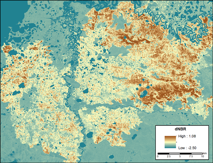
ABoVE: Landsat-derived Burn Scar dNBR across Alaska and Canada, 1985-2015
This dataset contains differenced Normalized Burned Ratio (dNBR) at 30-m resolution calculated for burn scars from fires that occurred within the Arctic Boreal and Vulnerability Experiment (ABoVE) project domain in Alaska and Canada during 1985-2015. The fire perimeters were obtained from the Alaskan Interagency Coordination Center (AICC) and the Natural Resources Canada (NRC) fire occurrence datasets. Only burns with an area larger than 200-ha were included. The dNBR for each burn scar at 30-m pixel resolution was derived from pre- and post-burn Landsat 5, 7, and 8 scenes within a 5-km buffered area surrounding each burn scar using Landsat LEDAPS surface reflection image pairs.
Data Citation:
Loboda, T.V., D. Chen, J.V. Hall, and J. He. 2018. ABoVE: Landsat-derived Burn Scar dNBR across Alaska and Canada, 1985-2015. ORNL DAAC, Oak Ridge, Tennessee, USA. https://doi.org/10.3334/ORNLDAAC/1564
Data center: ORNL DAAC
Sponsor: NASA EOSDIS
