
CMS: Landsat-derived Annual Land Cover Maps for the Colombian Amazon, 2001-2016
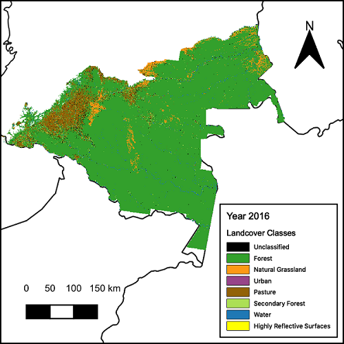
This dataset from the NASA Carbon Monitoring System (CMS) provides annual maps of land cover classes for the Colombian Amazon from 2001 through 2016. These maps were created by classifying time segments detected by the Continuous Change Detection and Classification (CCDC) algorithm. This algorithm detected changes in Landsat pixel surface reflectance across the time series, and the time segments were classified into land cover types using a random forest classifier with manually collected training data. Annual maps of land cover were created for each Landsat scene and then post-processed and mosaicked. Land cover types include unclassified, forest, natural grasslands, urban, pastures, secondary forest, water, or highly reflective surfaces.
The NASA CMS program is designed to make significant contributions in characterizing, quantifying, understanding, and predicting the evolution of global carbon sources and sinks through improved monitoring of carbon stocks and fluxes. The System uses NASA satellite observations and modeling/analysis capabilities to establish the accuracy, quantitative uncertainties, and utility of products for supporting national and international policy, regulatory, and management activities. CMS data products are designed to inform near-term policy development and planning.
Additional data from the NASA CMS program and other relevant links can be found on the ORNL DAAC's CMS Project Page.
Data Citation: Arévalo, P. 2020. CMS: Landsat-derived Annual Land Cover Maps for the Colombian Amazon, 2001-2016. ORNL DAAC, Oak Ridge, Tennessee, USA. https://doi.org/10.3334/ORNLDAAC/1783