
NAFD-ATT Forest Canopy Cover Loss from Landsat, CONUS, 1986-2010
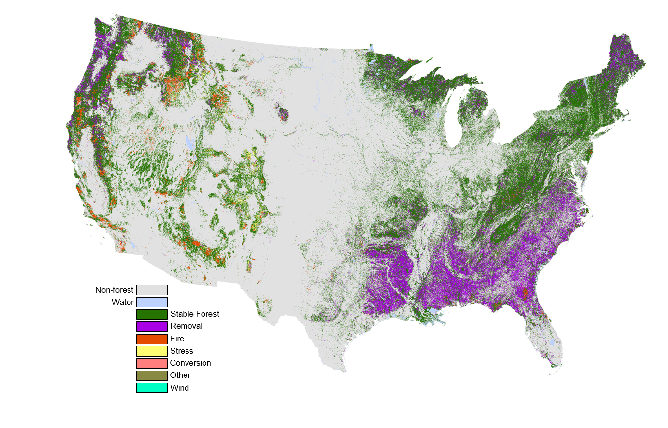
This spatial dataset from the North American Carbon Program (NACP), known as North American Forest Dynamics Attribution (NAFD-ATT), is designed to improve the understanding of the carbon budget for the conterminous United States (CONUS) using 25 years of Landsat observations. The dataset provides high resolution forest change owing to canopy cover loss across 258 million hectares derived from Landsat images for the period 1986-2010. The characteristics are summarized in four separate data layers. The first layer labels the type of change event (i.e, stable-no change, removals, fire, stress, wind, conversion, other), the second labels the year of the event, the third and fourth layers measure dominance and diversity, measures of qualitative confidence metrics derived from the model predictions. For each pixel, the data depict the greatest magnitude event occurring between 1986-2010. These products are produced in collaboration with the supercomputing facilities at the NASA Ames Research Center provided by the NASA Earth Exchange. NAFD was a core project of the NACP, and a long term collaboration between NASA, the University of Maryland, and the US Forest Service Forest Inventory and Analysis (USFS FIA) program.
The NACP is a multidisciplinary research program designed to improve understanding of North America's carbon sources, sinks, and stocks. The central objective is to measure and understand the sources and sinks of Carbon Dioxide (CO2), Methane (CH4), and Carbon Monoxide (CO) in North America and adjacent oceans. The NACP is supported by a number of different federal agencies.
Additional data from NACP and other relevant links can be found on the ORNL DAAC's NACP Project Page.
Data Citation: Schleeweis, K., G.G. Moisen, C. Toney, T.A. Schroeder, C. Huang, E.A. Freeman, S.N. Goward, and J.L. Dungan. 2020. NAFD-ATT Forest Canopy Cover Loss from Landsat, CONUS, 1986-2010. ORNL DAAC, Oak Ridge, Tennessee, USA. https://doi.org/10.3334/ORNLDAAC/1799