
Sources of Methane Emissions (Vista-CA), State of California, USA
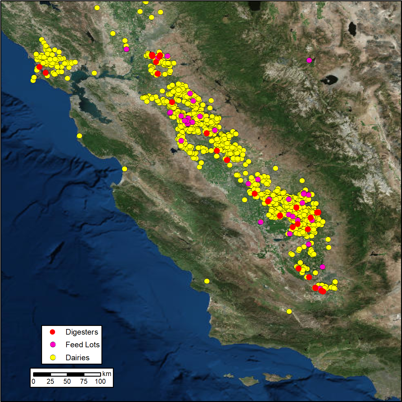
This dataset from the North American Carbon Program (NACP) provides spatial data products with identified and organized locations of potential methane (CH4) emitting facilities and infrastructure spanning the State of California. These data products form a GIS-based mapping database designed to address shortcomings in current CH4 source inventories and is known as Vista California (Vista-CA). Vista-CA consists of detailed spatial maps for facilities and infrastructure in California that are known or expected sources of CH4 emissions and illustrates the spatial distribution of potential CH4 sources. Vista-CA spatial data sets were created utilizing an assortment of publicly available data sources from local, state, and federal agencies for the years 2005 to 2019. The final Vista-CA database contains over 230,000 entries, which are presented as fifteen CH4 emitting infrastructure maps. The database was used to support flight planning and source attribution for the California Methane Survey project.
The NACP is a multidisciplinary research program designed to improve understanding of North America's carbon sources, sinks, and stocks. The central objective is to measure and understand the sources and sinks of Carbon Dioxide (CO2), Methane (CH4), and Carbon Monoxide (CO) in North America and adjacent oceans. See all ORNL DAAC data from the NACP.
Data Citation: Hopkins, F.M., T. Rafiq, and R.M. Duren. 2019. Sources of Methane Emissions (Vista-CA), State of California, USA. ORNL DAAC, Oak Ridge, Tennessee, USA. https://doi.org/10.3334/ORNLDAAC/1726
Data Center: ORNL DAAC
Sponsor: EOSDIS
