
ABoVE: Ecosystem Map, Great Slave Lake Area, Northwest Territories, Canada, 1997-2011
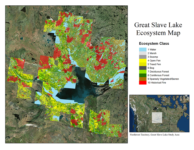
This dataset from the Arctic-Boreal Vulnerability Experiment (ABoVE) provides a map of ecosystems at 12.5 meter pixel spacing and 0.2 ha minimum mapping unit for the area surrounding Great Slave Lake, Northwest Territories, Canada, for the time period 1997 to 2011. The map includes ecosystem classes for peatland, wetland, and upland areas derived from a random forest classification trained on multi-date, multi-sensor remote sensing images across the study extent, and using field data and high-resolution Worldview-2 image interpretation for training and validation. This ecosystem-type map will help the area's researchers to better understand the effects of fires.
ABoVE is a NASA Terrestrial Ecology Program field campaign conducted in Alaska and western Canada between 2016 and 2021. See all ORNL DAAC data from ABoVE.
Data Citation: Bourgeau-Chavez, L.L., J.A. Graham, S. Endres, N.H.F. French, M. Battaglia, D. Hansen, and D. Tanzer. 2019. ABoVE: Ecosystem Map, Great Slave Lake Area, Northwest Territories, Canada, 1997-2011. ORNL DAAC, Oak Ridge, Tennessee, USA. https://doi.org/10.3334/ORNLDAAC/1695
Data Center: ORNL DAAC
Sponsor: EOSDIS
