
ABoVE: Soil Temperature Profiles at USArray Seismic Stations, Alaska, 2016-2018
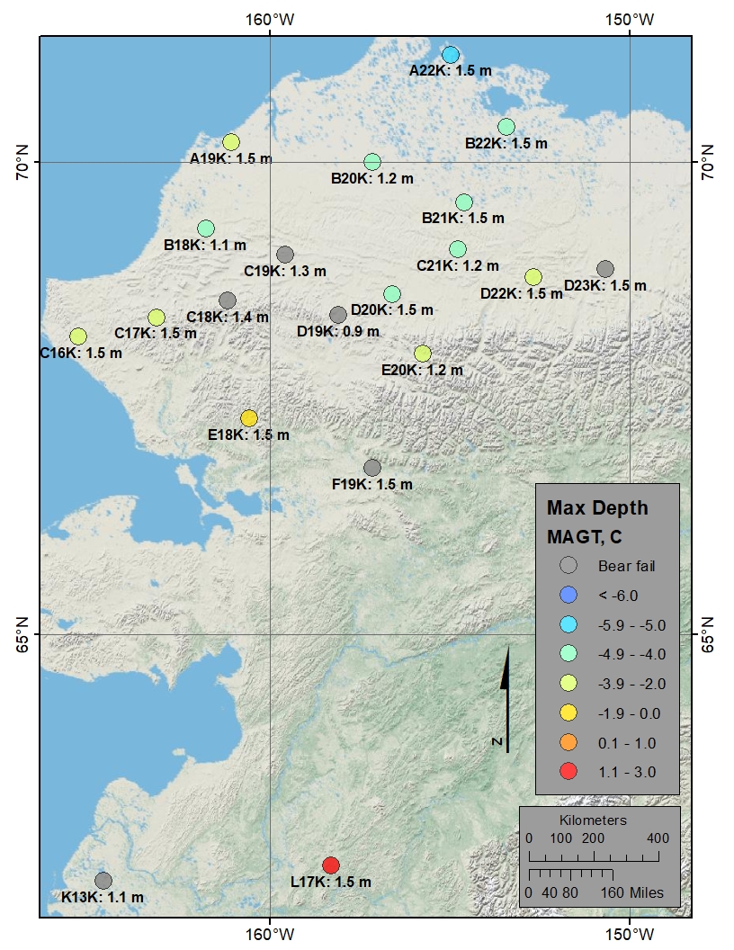
This new Arctic-Boreal Vulnerability Experiment (ABoVE) dataset includes soil temperature profile measurements taken three times per day at 20 seismic monitoring sites associated with the USArray program, located in interior Alaska. Data were collected primarily from the summer of 2017 through the summer of 2018. At one station, measurements start in 2016. These measurements were taken using temperature probes installed at four depths from the surface to a target maximum depth of 1.5 meters and recorded with HOBO data loggers.
ABoVE is a NASA Terrestrial Ecology Program field campaign that will take place in Alaska and western Canada between 2016 and 2021. Research for ABoVE will link field-based, process-level studies with geospatial data products derived from airborne and satellite sensors, providing a foundation for improving the analysis, and modeling capabilities needed to understand and predict ecosystem responses and societal implications. See all ORNL DAAC data from ABoVE.
Data Citation: Nicolsky, D.J., V.E. Romanovsky, A.L. Kholodov, K. Dolgikh, and N. Hasson. 2019. ABoVE: Soil Temperature Profiles at USArray Seismic Stations, Alaska, 2016-2018. ORNL DAAC, Oak Ridge, Tennessee, USA. https://doi.org/10.3334/ORNLDAAC/1680
Data Center: ORNL DAAC
Sponsor: EOSDIS
