
ABoVE: Subsistence Resource Use Areas of Interior Alaskan Communities, 2011-2017
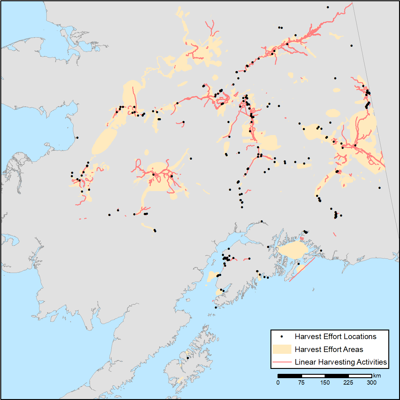
This new Arctic-Boreal Vulnerability Experiment (ABoVE) dataset provides maps of the search and harvest areas used by community residents for all subsistence resources combined across Interior Alaska for the years 2011-2017. The data include the extent of areas used by residents, the species harvested, the amounts harvested, and the location and months of harvest. The data are a composite collected by the Division of Subsistence, Alaska Department of Fish and Game, using standardized methods and does not represent a comprehensive use map for the entire area.
ABoVE is a NASA Terrestrial Ecology Program field campaign conducted in Alaska and western Canada between 2016 and 2021. Research for ABoVE links field-based, process-level studies with geospatial data products derived from airborne and satellite sensors, providing a foundation for improving the analysis, and modeling capabilities needed to understand and predict ecosystem responses to, and societal implications of, climate change in the Arctic and Boreal regions. See all ORNL DAAC data from ABoVE.
Data Citation: Neufeld, G., L. Naaktgeboren, D. Gonzalez, and C. Brown. 2019. ABoVE: Subsistence Resource Use Areas of Interior Alaskan Communities, 2011-2017. ORNL DAAC, Oak Ridge, Tennessee, USA. https://doi.org/10.3334/ORNLDAAC/1725
Data Center: ORNL DAAC
Sponsor: EOSDIS
