
Three new datasets have been published from the Carbon Monitoring System (CMS) that were derived from National Agriculture Imagery Program data (2013-2015) and cover six estuarine regions of the conterminous United States: Cape Cod, MA; Chesapeake Bay, MD, Everglades, FL; Mississippi Delta, LA; San Francisco Bay, CA; and Puget Sound, WA. The CMS is designed to make significant contributions in characterizing, quantifying, understanding, and predicting the evolution of global carbon sources and sinks through improved monitoring of carbon stocks and fluxes.
Green Vegetation Fraction High-Resolution Maps for Selected US Tidal Marshes, 2015
This dataset provides 30m resolution maps of the fraction of green vegetation (FGV) for each estuarine region.
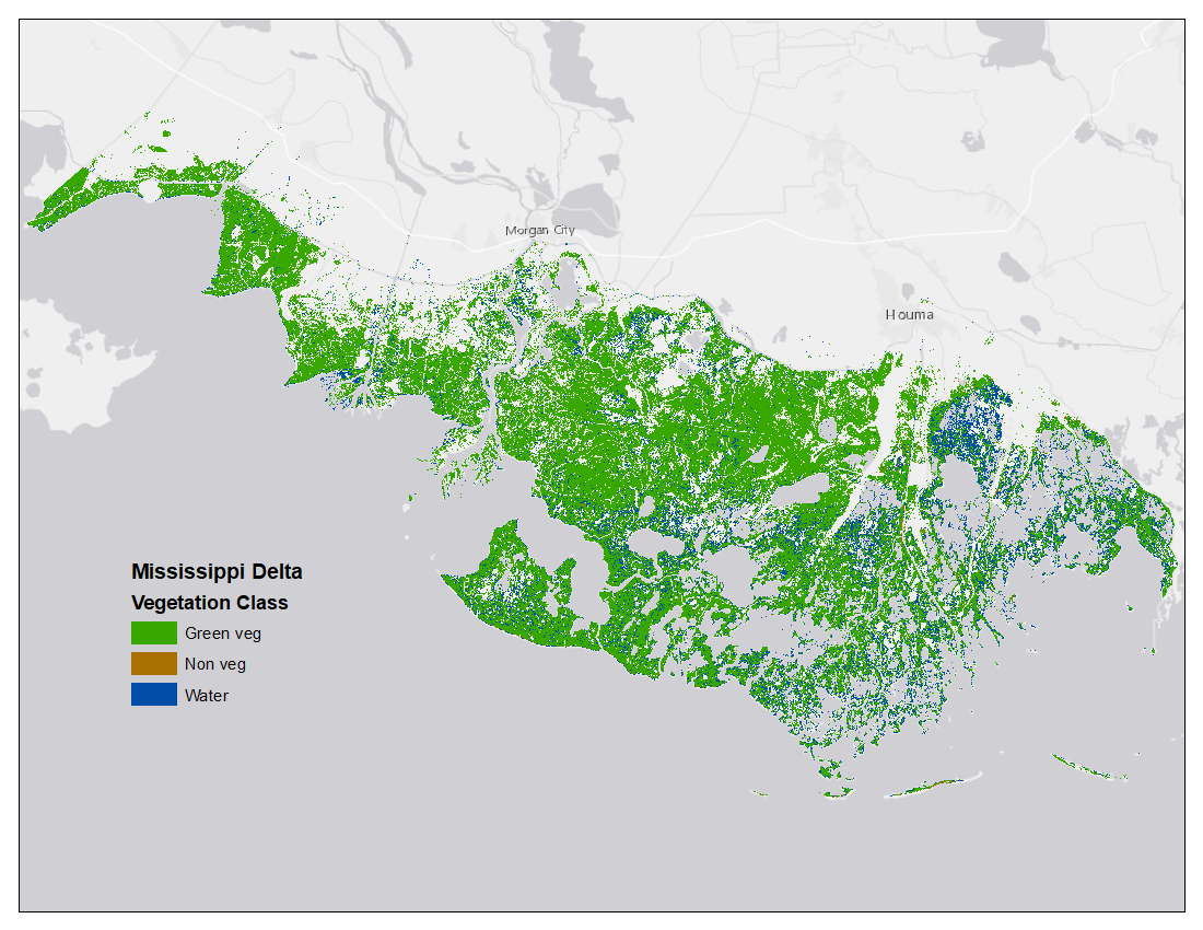
Vegetation and Open Water High-Resolution Maps for Selected US Tidal Marshes, 2015
This dataset provides 1m resolution maps of tidal marsh area classified as green vegetation, non-vegetation, or open water.
Aboveground Biomass High-Resolution Maps for Selected US Tidal Marshes, 2015
This dataset provides 30m resolution maps of aboveground tidal marsh biomass (g/m2).
See all data from NASA's Carbon Monitoring System.
Data Citations:
Ballanti, L., and K.B. Byrd. 2018. Green Vegetation Fraction High-Resolution Maps for Selected US Tidal Marshes, 2015. ORNL DAAC, Oak Ridge, Tennessee, USA. https://doi.org/10.3334/ORNLDAAC/1608
Ballanti, L., and K.B. Byrd. 2018. Vegetation and Open Water High-Resolution Maps for Selected US Tidal Marshes, 2015. ORNL DAAC, Oak Ridge, Tennessee, USA. https://doi.org/10.3334/ORNLDAAC/1609
Byrd, K.B., L. Ballanti, N. Thomas, D. Nguyen, J.R. Holmquist, M. Simard, and L. Windham-Myers. 2018. Aboveground Biomass High-Resolution Maps for Selected US Tidal Marshes, 2015. ORNL DAAC, Oak Ridge, Tennessee, USA. https://doi.org/10.3334/ORNLDAAC/1610
