
ABoVE: Burn Severity of Soil Organic Matter, Northwest Territories, Canada, 2014-2015
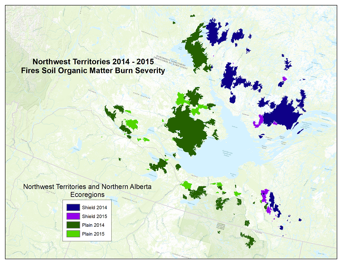
This dataset from the Arctic-Boreal Vulnerability Experiment (ABoVE) provides maps at a 30 m resolution of landscape surface burn severity from the 2014-2015 fires in the Northwest Territories and Northern Alberta, Canada. The maps were derived from Landsat 8 Operational Land Imager/Thermal Infrared Sensor (OLI/TIRS) imagery and two separate multiple linear regression models trained with field data; one for the Plains and a second for the Shield ecoregion. Field observations were used to estimate area burned in each of five severity classes. Using this five-class scale, a burn severity index (BSI) for each 1 ha site was calculated. Pre- and post-fire phenologically paired Landsat 8 images were used to model the five discrete severity classes.
ABoVE is a NASA Terrestrial Ecology Program field campaign taking place in Alaska and western Canada, for 8 to 10 years, starting in 2015. Research for ABoVE links field-based, process-level studies with geospatial products derived from airborne and satellite sensors, providing a foundation for improving the analysis, and modeling capabilities needed to understand and predict ecosystem responses to, and societal impacts of, climate change in the Arctic and Boreal regions. See all ORNL DAAC data from ABoVE.
Data Citation: French, N.H.F., J.A. Graham, S. Grelick, L. Jenkins, M. Battaglia, E.S. Kane, E. Serocki, E. Ernst, D. Tanzer, C. Bach, E. Hodges, E. Whitman, and L.L. Bourgeau-Chavez. 2020. ABoVE: Burn Severity of Soil Organic Matter, Northwest Territories, Canada, 2014-2015. ORNL DAAC, Oak Ridge, Tennessee, USA. https://doi.org/10.3334/ORNLDAAC/1694
Data Center: ORNL DAAC
Sponsor: EOSDIS

