
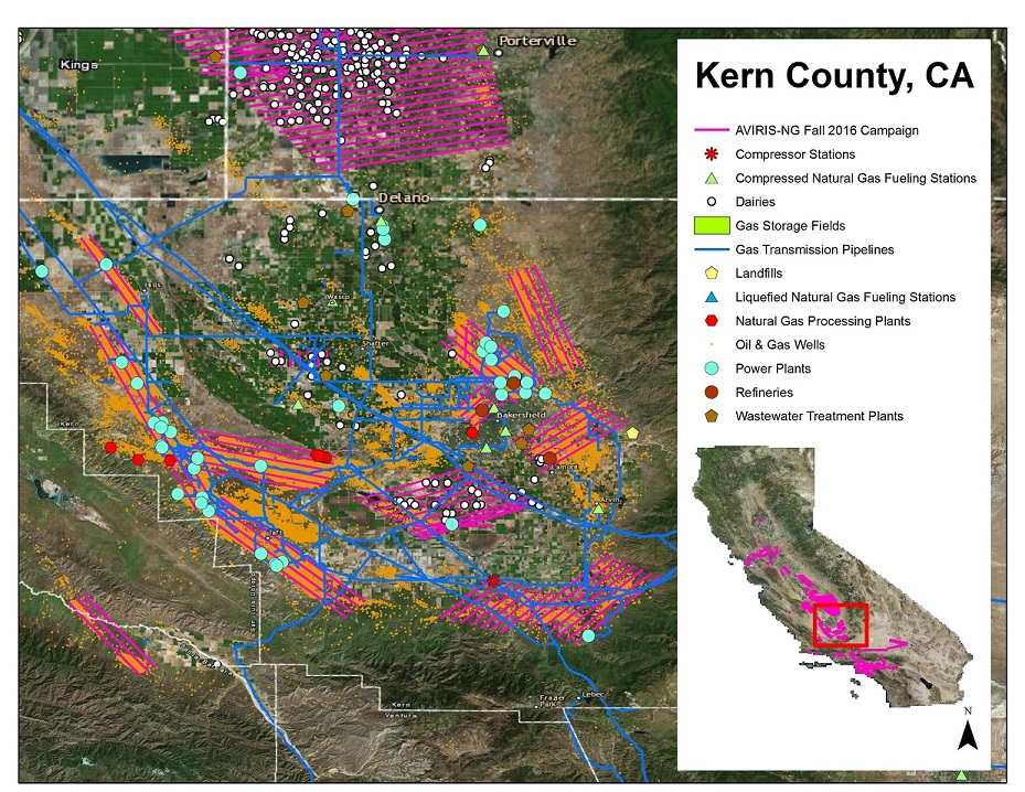
Methane Plumes Derived from AVIRIS-NG over Point Sources across California, 2016-2017
This dataset from the Carbon Monitoring System (CMS) provides maps of methane (CH4) plumes along flight lines over methane emitting point-sources across the State of California collected during 2016 and 2017. Methane plume locations were derived from Next-Generation Airborne Visible Infrared Imaging Spectrometer (AVIRIS-NG) overflights during the California Methane Survey. The purpose of the survey was to detect, quantify, and attribute point source emissions to specific infrastructure elements to improve the scientific understanding of regional methane budgets and to inform policy and planning activities that reduce methane emissions.
NASA's CMS program uses NASA satellite observations and modeling/analysis capabilities to establish the accuracy, quantitative uncertainties, and utility of products for supporting national and international policy, regulatory, and management activities. See all ORNL DAAC data from CMS.
Related Article:Duren, R.M., Thorpe, A.K., Foster, K.T. et al. California’s methane super-emitters. Nature 575, 180–184 (2019) doi:10.1038/s41586-019-1720-3
Data Citation: Thorpe, A.K., B.D. Bue, D.R. Thompson, and R.M. Duren. 2019. Methane Plumes Derived from AVIRIS-NG over Point Sources across California, 2016-2017. ORNL DAAC, Oak Ridge, Tennessee, USA. https://doi.org/10.3334/ORNLDAAC/1727
Data Center: ORNL DAAC
Sponsor: EOSDIS
