ABoVE: Vegetation Composition across Fire History Gradients on the Y-K Delta, Alaska
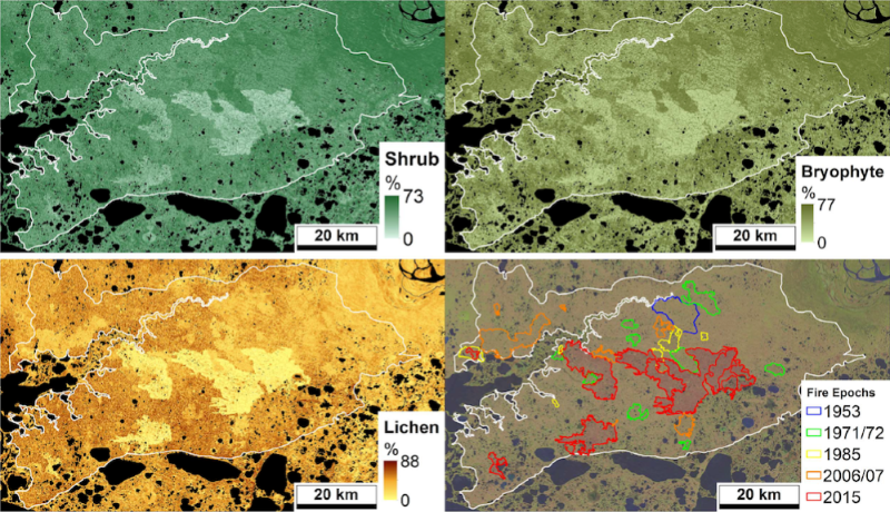
This dataset from the Arctic-Boreal Vulnerability Experiment (ABoVE) characterizes multi-decadal succession and landscape change across the Izaviknek and Kingaglia uplands of the Yukon-Kuskokwim (Y-K) Delta, Alaska, following extensive historical fire events. Ecological field data were collected during July 2017 and July 2018 from 43 plots spanning gradients of fire history. Plot-level data include vegetation species composition and structure, leaf area index (LAI), topography, thaw-depth, and soil characteristics collected at plots burned in 1971-1972, 1985, 2006-2007, 2015, or unburned controls. Vegetation species were sampled along transects using the vegetation point-intercept (VPI) sampling approach and summarized by three metrics of vegetation cover: (1) top-hit cover, (2) any-hit cover, and (3) multi-hit cover. The VPI any-hit cover metric data were combined with Landsat imagery to develop fractional maps of any-hit cover for four aggregated plant functional types (PFTs); bryophytes, herbs, lichen, and shrubs for the upland tundra area. Photographs of vegetation transects and soil pits are included.
ABoVE is a NASA Terrestrial Ecology Program field campaign being conducted in Alaska and western Canada, for 8 to 10 years, starting in 2015. Research for ABoVE links field-based, process-level studies with geospatial data products derived from airborne and satellite sensors, providing a foundation for improving the analysis, and modeling capabilities needed to understand and predict ecosystem responses to, and societal implications of, climate change in the Arctic and Boreal regions. See all ORNL DAAC data from ABoVE.
Data Citation: Frost, G.V., R.A. Loehman, P.R. Nelson, and D.P. Paradis. 2020. ABoVE: Vegetation Composition across Fire History Gradients on the Y-K Delta, Alaska. ORNL DAAC, Oak Ridge, Tennessee, USA. https://doi.org/10.3334/ORNLDAAC/1772

