
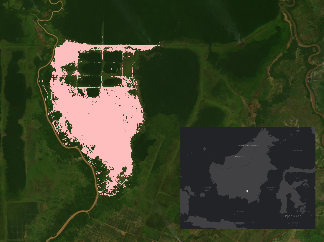
Annual Burned Area from Landsat, Mawas, Central Kalimantan, Indonesia, 1997-2015
The Mawas area is a large peatland forest that has undergone numerous historical and recent human manipulations affecting land cover and ground water elevations. Fire disturbance is a major factor shaping this ecosystem and is important to ongoing conservation and restoration projects. This dataset provides maps of annual burned area for the Mawas region of Central Kalimantan, Indonesia from 1997 through 2015. Landsat imagery (TM, ETM+, OLI/TIR) at 30 m resolution was obtained for this 19-year period, including the variables surface reflectance, brightness temperature, and pixel quality assurance, plus the indices NDVI, NDMI, NBR, NBR2, SAVI, and MSAVI. The MODIS active fire product (MCD14) was used to define when fires occurred. Random Forest classifications were used to separate burned and unburned 30-m pixels with inputs of composites of Landsat indices and thermal bands, based on the pre- and post-fire values.
This dataset is part of NASA's Carbon Monitoring System, which is designed to make significant contributions in characterizing, quantifying, understanding, and predicting the evolution of global carbon sources and sinks through improved monitoring of carbon stocks and fluxes. See all ORNL DAAC data from CMS.
Data Citation: Cochrane, M.A., and Y. Vetrita. 2019. Annual Burned Area from Landsat, Mawas, Central Kalimantan, Indonesia, 1997-2015. ORNL DAAC, Oak Ridge, Tennessee, USA. https://doi.org/10.3334/ORNLDAAC/1708
Data Center: ORNL DAAC
Sponsor: EOSDIS
