
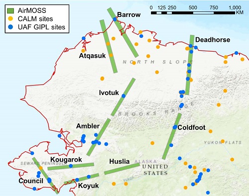
Pre-ABoVE: L1 S-0 Polarimetric Data from AirMOSS P-band SAR, Alaska, 2014-2015
This dataset was collected by the Airborne Microwave Observatory of Subcanopy and Subsurface (AirMOSS) radar instrument for the Arctic-Boreal Vulnerability Experiment (ABoVE). The dataset includes Level 1 (L1) polarimetric radar backscattering coefficient (sigma-0), multi-look complex, polarimetrically calibrated, and georeferenced data products for 10 study sites across Northern Alaska. Flight campaigns took place in August 2014, October 2014, April 2015, August 2015, September 2015, and October 2015. The acquired L1 P-band radar backscatter data will be used to derive estimates of soil water content and permafrost state at the study sites.
The AirMOSS radar is a P-band (UHF) fully polarimetric synthetic aperture radar (SAR) currently operating in the 420-440 MHz band designed to measure root-zone soil moisture (RZSM) and is flown on a NASA Gulfstream-III aircraft. ABoVE is a NASA Terrestrial Ecology Program field campaign conducted in Alaska and western Canada between 2016 and 2021 that links field-based, process-level studies with geospatial data products derived from airborne and satellite sensors. See all ORNL DAAC data from ABoVE.
Data Citation: Moghaddam, M. 2019. Pre-ABoVE: L1 S-0 Polarimetric Data from AirMOSS P-band SAR, Alaska, 2014-2015. ORNL DAAC, Oak Ridge, Tennessee, USA. https://doi.org/10.3334/ORNLDAAC/1678
Data Center: ORNL DAAC
Sponsor: EOSDIS

