Body
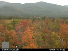
A new R package "phenopix" provides tools for the automated extraction of chromatic coordinates and the analysis of image timeseries collected with PhenoCam digital cameras.

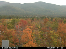
A new R package "phenopix" provides tools for the automated extraction of chromatic coordinates and the analysis of image timeseries collected with PhenoCam digital cameras.
A new user registration system will soon provide centralized user profile management and greater access for users.

Field measurements and satellite imagery were used to investigate the structural characteristics of shrubs across the North Slope of Alaska.
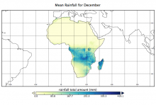
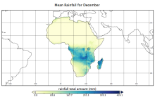
A new climate data set describes the annual timing and mean amount of rainfall over the African continent and Madagascar for 1998-2012.
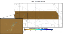
The distribution of permanent and ephemeral water bodies in the African Sahel region is mapped in a new data set.

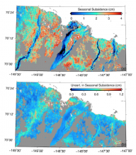
Remote sensing was used to measure the thickness of the active layer in regions of the North Slope of Alaska in two new data sets.

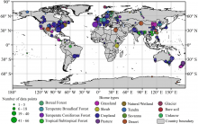
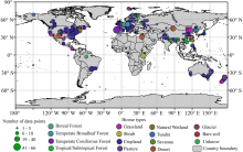
A new comprehensive data set describes soil microbial biomass carbon, nitrogen, and phosphorus concentrations at biome and global scales.
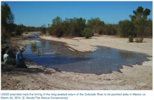
USGS scientists track the timing of the long-awaited return of the Colorado River to its parched delta in Mexico on March 24, 2014.
Do we have enough water to meet our needs, now and in the future? Daymet, a meteorological data product at the ORNL DAAC, may help find the answer.

The Amazon, largest expanse of tropical forest on Earth, has been experiencing rapid land cover change as a consequence of economic development.
New LBA-ECO soil and vegetation data for Cerrado and forested sites in Brazil has been published.