Body
High-resolution and globally consistent hydrologic soil groups are provided in a new dataset.


Global distribution of hydrologic soil groups at 250-m spatial resolution. Hydrologic soil groups A, B, C, and D correspond to low, moderately low, moderately high, and high runoff potential, respectively. Wet soils are assigned a dual HSG (e.g., HSG A/D) and have high runoff potential due to the presence of a water table within 60 cm of the surface. A less restrictive group can be assigned if these soils are drained (e.g., HSG-A).
High-resolution and globally consistent hydrologic soil groups are provided in a new dataset.

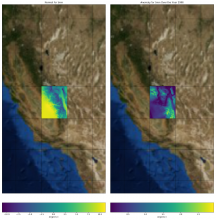
Climate anomaly (right panel) in minimum daily temperature for year 1990 compared to the long-term normal (left panel). The climate normal and anomaly were calculated for a single 2-degree tile from the Daymet dataset.
New Jupyter notebook tutorials show how to access and visualize Daymet climate data from within Python and how to calculate climate normals and anomalies.

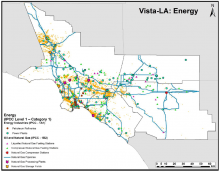
Locations for infrastructures associated with the energy industry with known or expected potential to emit CH4 in the South Coast Air Basin (SoCAB). Vista-LA includes a total of 33,614 features across 13 layers. From Carranza et al., 2017.
A new dataset from Vista-LA provides an inventory of potential methane emitting facilities in the greater Los Angeles urban area.

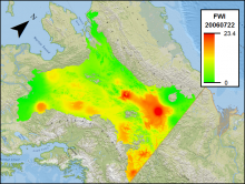
Fire Weather Index (FWI) for Interior Alaska on July 22, 2006. FWI is a numerical rating between 0 and 30 where higher values indicate a higher risk of wildfire.
New data from Alaska quantify the daily weather conditions and risk of wildfire from 2001 to 2010.
 for Interior Alaska")
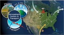
The Atmospheric Carbon and Transport America (ACT-America) project is conducting airborne campaigns across three regions in the eastern United States to study the transport of atmospheric carbon.
NASA's ACT-America mission measured atmospheric CO2, CO, CH4, and O3 concentrations across the Eastern USA in 2016.

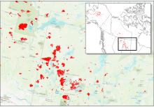
Date of Burning (DoB) was estimated for areas within each fire scar across Alaska and Canada. In this figure, red areas are fire scar locations across central Canada in 2015.
New data from NASA's ABoVE project provide maps of the date of burning within fire scars across Alaska and Canada from 2001-2015.

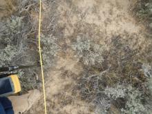
Typical plot photo for ground cover estimates and location of LAI measurements. A rangepole with GPS and a camera boom was positioned at 2-meter intervals along plot transects. This photo is from the Hollister, Sagebrush01 plot, and the Sagebrush01_5_4 sampling point.
New field data describes vegetation in southern Idaho in order to validate remotely-sensed data in the region.


American Geophysical Union Fall Meeting 2017

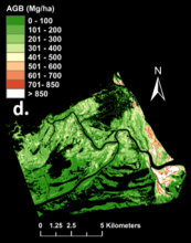
Zambezi Delta mangrove aboveground biomass map derived from Chave power method (from Fatoyinbo et al. 2017).
Estimates of mangrove forest biomass provide data on carbon storage in the Zambezi River Delta of Mozambique.

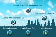
NASA Carbon Monitoring System (CMS)
Eight new carbon flux datasets have been released by the Goddard Earth Sciences (GES) Data and Information Services Center (DISC).
")