Body
If you missed our recent Webinar on subsetting remote sensing data, a new ORNL DAAC Learning Resource provides access at your convenience.

GEDI Beam 101 shot number 24610500300213454 illustrating aboveground biomass.
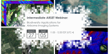
Invitation to participate in NASA's ARSET online webinar series: Biodiversity Applications for Airborne Imaging Systems.
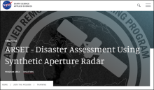
ARSET - Disaster Assessment Using Synthetic Aperture Radar webinar banner.
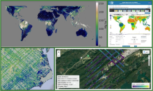
A set of example visualizations for GEDI mission data products.
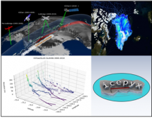
Laser Altimetry Datasets from NASA's ICESAT, IceBridge, and ICESat-2 missions are harmonized with Python tools to understand the evolution of land and sea ice.
The webinar describes step-by-step methods, software, and tools that can be used to create, visualize, and standardize netCDF files.
The tutorial code and recording from our NASA Earthdata webinar "NetCDF Why and How: Creating Publication Quality NetCDF Datasets" is now available.

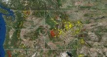
The webinar featured data on the locations of forest disturbance by fire (red) and insect infestation (yellow) across northwestern USA between 2006 and 2010.
The recording of our NASA Earthdata webinar on "Introduction to Geospatial Analysis in R" is now available.
