Body
NASA's ACT-America mission measured atmospheric CO2, CO, CH4, and O3 concentrations across the Eastern USA in 2016.

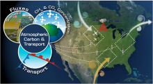
The Atmospheric Carbon and Transport America (ACT-America) project is conducting airborne campaigns across three regions in the eastern United States to study the transport of atmospheric carbon.
NASA's ACT-America mission measured atmospheric CO2, CO, CH4, and O3 concentrations across the Eastern USA in 2016.

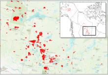
Date of Burning (DoB) was estimated for areas within each fire scar across Alaska and Canada. In this figure, red areas are fire scar locations across central Canada in 2015.
New data from NASA's ABoVE project provide maps of the date of burning within fire scars across Alaska and Canada from 2001-2015.

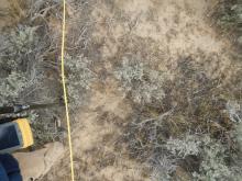
Typical plot photo for ground cover estimates and location of LAI measurements. A rangepole with GPS and a camera boom was positioned at 2-meter intervals along plot transects. This photo is from the Hollister, Sagebrush01 plot, and the Sagebrush01_5_4 sampling point.
New field data describes vegetation in southern Idaho in order to validate remotely-sensed data in the region.


American Geophysical Union Fall Meeting 2017

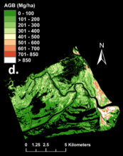
Zambezi Delta mangrove aboveground biomass map derived from Chave power method (from Fatoyinbo et al. 2017).
Estimates of mangrove forest biomass provide data on carbon storage in the Zambezi River Delta of Mozambique.


A full moon illuminates this power plant near Seal Beach in Rossmoor, California, not far from Los Angeles. (Courtesy alkhodarev/Flickr)
Radiocarbon and satellite data hint at the future of California emissions.

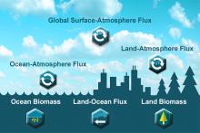
NASA Carbon Monitoring System (CMS)
Eight new carbon flux datasets have been released by the Goddard Earth Sciences (GES) Data and Information Services Center (DISC).
")
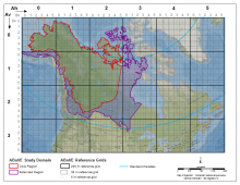
The ABoVE Study Domain with Core and Extended study regions and the Standard Reference Grid showing the nested 240 and 30 meter tiling scheme.
An updated version of the standard reference grid for NASA's ABoVE campaign has been released.

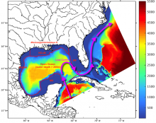
Domain of the South Atlantic Bight and Gulf of Mexico (SABGOM) model showing water depth (m). For analysis, the Gulf was divided into five subregions used in this study, which are Mexico Shelf (MX), Western Gulf of Mexico Shelf (WGoM), Northern Gulf of Mexico Shelf (NGoM), West Florida Shelf (WF), and open ocean. Arrows indicate the Loop Current (figure from Xue et al., 2016).
Output from the South Atlantic Bight and Gulf of Mexico (SABGOM) model provides insight into biogeochemical cycling and three-dimensional ocean circulation in a gulf-wide context.
 model")
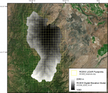
Digital elevation model and LiDAR tile boundaries for the area encompassing the Reynolds Creek Experimental Watershed in southwestern Idaho.
LiDAR data collected over southern Idaho was used to derive a high resolution digital elevation model and map of vegetation height across a strong regional climate gradient.
