Body
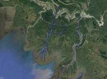
Spatial data on water channels define open water paths in the estuary of the Atchafalaya Basin of the Mississippi River Delta of coastal Louisiana.

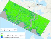
Water channels (blue) in the Atchafalaya Basin of the Mississippi River Delta of coastal Louisiana, U.S., during low tide on October 16, 2016
Delta-X is a 5-year NASA EVS-3 mission to study the Mississippi River Delta in the United States, which is growing and sinking in different areas.
Delta-X is a 5-year NASA Earth Venture Suborbital-3 mission to study the subsidence and growth of the Mississippi River Delta in the United States.
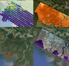
Collage of dataset airborne imagery from AirSWOT, UAVSAR and the ASO lidar instrument provide examination of water level elevation estimates and changes.
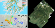
Pre-DeltaX image highlights: AVIRIS-NG/UAVSAR Biomass (upper left), AVIRIS-NG Total Suspended Solids (lower left), and AVIRIS-NG Surface Reflectance (right).
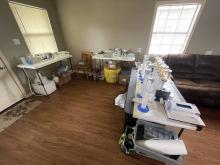
The Channel Team's water filtering lab inside a local cabin. The team will process 800 liters of water to extract as little as ~100mg of material found in a liter of Mississippi water.
In blue, the extent of the Fall 2016 channel bathymetry survey in the main channels of the Atchafalaya and Wax Lake Deltas.
Bathymetry data are available for a major channel of the Mississippi River Delta.
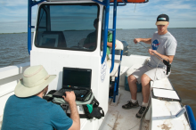
Collecting in situ spectral reflectance data with the Analytical Spectral Devices (ASD) FieldSpec 3 on the Atchafalaya River.
A new dataset provides hand-held spectrometer measurements collected across the Atchafalaya and Terrebonne basins.
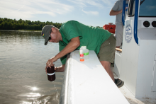
Collection of surface water samples in the Atchafalaya River for total suspended solids (TSS) analysis.
TSS was sampled across a variety of hydrodynamic and physical settings to represent basin heterogeneity.
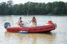
Measurement of river discharge across channels.
Two new Pre-Delta-X datasets provide absolute water level elevations and river discharge measurements.