Image Media
Body
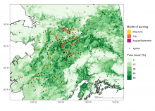
Workshop hosted by ORNL's Biological and Environmental Systems Science Directorate and the Consortium of Appalachian Fire Managers and Scientists, September 1-2, 2021.
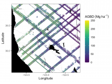
First GEDI Level 4 Biomass Data Highlighted by NASA's Earthdata
Image Media
Body
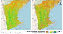
GEDI L4A Footprint Level Aboveground Biomass Density, Version 1 released.
Earthdata Webinar: Daymet V4 - Toward Analysis Ready Data
Image Media
Body
Learn how to programmatically discover, access, and subset Daymet V4 Data with Python and ArcGIS, August 31, 2021 at 2:00 EDT.
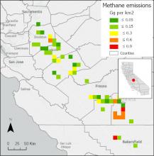
Methane Emissions from Dairy Sources (Vista-CA)
Image Media
Body
This dataset provides estimates of methane (CH4) emissions from dairies in California at a resolution of 0.1 degrees (~ 10 km x 10 km) for the year 2019.
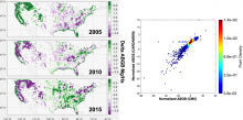
Carbon Stocks, Emissions, and Fluxes for contiguous USA, 2001-2016
Image Media
Body
16 years of carbon pools and fluxes estimated from CARDAMOM for the contiguous USA at 0.5-degree resolution recently published.
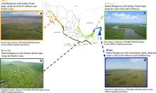
Estimates for Mexico's Costal Mangrove Forests
Image Media
Body
Estimates of greenness trends, carbon stocks, and climate variables for Mexico's coastal mangrove forests, 2001-2015 available.
Fire Ignitions, Burned Area, and Emissions, 2001-2018
Image Media
Body
New estimates of daily fire ignitions, burned area, and emissions for Alaska, Yukon and Northwest Territories available from ABoVE.
ATom: Light-Absorbing Metallic Aerosols, 2016-2018
Image Media
Body
Mass mixing ratios and number density of light-absorbing metallic aerosols (LAM) measured during the NASA ATom airborne mission now available.
CASEI: A Discovery Catalog of NASA Airborne and Field Campaigns
Image Media
Body
NASA announces a new Catalog of Archived Suborbital Earth Science Investigations (CASEI) dedicated to improving information and data access for users of NASA airborne and field data.
Global High-Resolution Estimates of Solar Induced Fluorescence
Image Media
Body
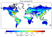
This dataset provides monthly global solar-induced chlorophyll fluorescence (SIF) estimates from fused SCIAMACHY and GOME-2 at a 0.05-degree resolution from August 2002 through December 2018.