Body
Global flare site surveys from 2012-2019 derived from VIIRS on the Suomi National Polar Partnership satellite.

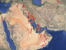
Representation of gas flares recorded over the Persian Gulf in 2019 by Earth Observation Group's Global Gas Flare Survey.
New ARSET Training: Using Earth Observations for Pre- and Post-Fire Monitoring, January 18 and 20, 2022 from 12:00 to 3:00 EST.
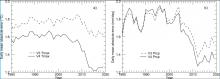
Annual timeseries of daily cross-validation mean absolute error (MAE), averaged over all station days for each year, comparing results for Daymet V4 and Daymet V3. (a) MAE for estimation of daily maximum temperature. (b) MAE for estimation of daily total precipitation. Image from Thornton et al. 2021.
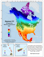
Daymet Version 3 Average Daily Maximum Temperature in 2012.
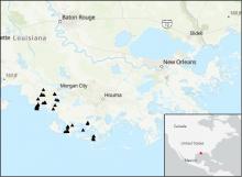
Locations of river discharge measurements (black triangles) in the Atchafalaya and Terrebonne Basins within the Mississippi River Delta (MRD) floodplain in coastal Louisiana, U.S. Measurements were taken by Delta-X project in March and April 2021.
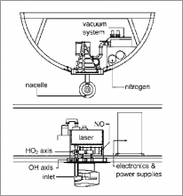
A schematic of ATHOS looking from in front of the electronics rack (top) and from the DC-8 aircraft's port side (bottom).

NASA's DC-8 flying laboratory. All four ATom campaigns were conducted with DC-8.
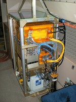
The Harvard QCLS (DUAL and CO2) instrument package contains two optical assemblies, calibration and common data systems, and power supply.
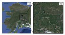
Map indicating the location of the study sites.
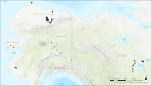
Locations of boreal forest stands in interior Alaska where forest structure and composition were measured and compared to remotely-sensed NDVI trends (Fiore et al., 2020).