Body
The tutorial code and recording from our NASA Earthdata webinar "NetCDF Why and How: Creating Publication Quality NetCDF Datasets" is now available.

The webinar describes step-by-step methods, software, and tools that can be used to create, visualize, and standardize netCDF files.
The tutorial code and recording from our NASA Earthdata webinar "NetCDF Why and How: Creating Publication Quality NetCDF Datasets" is now available.

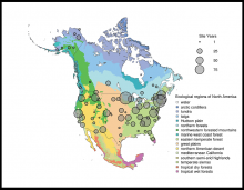
Spatial distribution of PhenoCam data across ecological regions of North America. Background map illustrates USA Environmental Protection Agency Level I Ecoregions. Data counts have been aggregated to a spatial resolution of 4i, and the size of each circle corresponds to the number of years of data.
A new version of the PhenoCam vegetation phenology data products is now available.

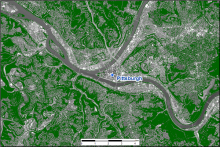
Estimated tree canopy cover (in green) near Pittsburgh, Pennsylvania, for the year 2008.
Statewide tree canopy cover at 1m resolution is now available for Maryland and Delaware.

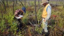
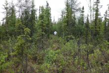
Investigators collected field data and inventoried plots for vegetation species and growth in 2018 at a post-burn site. (Image Credit: Laura Bourgeau-Chavez)
A new dataset completes four years of post-fire vegetation sampling at burned sites in Canada's Northwest Territories.

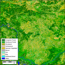
Land cover (10-class product) for the year 2014 for ABoVE tile BH03V04. The pixel resolution is 30 m and a tile is 180 x 180 km.
Research from NASA's ABoVE project provides annual land cover classifications from 1984 to 2014 for Alaska and the Canadian Arctic.

Estimates of the height of the planetary boundary layer (PBL) are available from the Atmospheric Carbon and Transport - America (ACT-America) airborne campaign.

Active layer thaw depth was recorded each year during the late summer from 2014 - 2018 at sites including the Farmer's Loop Transect 2 near Fairbanks. (Image Credit: Tom Douglas)
Two new datasets provide soil active layer thaw depth and end-of-season snow depth at sites near Fairbanks, Alaska.

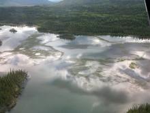
This photo from June 2016 shows the 'extreme' growth of lake grass in a lake near the Tok Community, Alaska.
ABoVE researchers worked with rural communities to document environmental changes that affect access to subsistence resources.

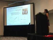
ORNL DAAC Chief Scientist Alison Boyer describes one of her favorite publications that demonstrates how data archived at the ORNL DAAC can be used in ecological research.
Materials are available from a recent workshop presented at the 2019 Ecological Society of America meeting.

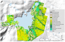
Vegetation communities for the Toolik footprint shown at 1:25,000 scale.
Plant communities near Toolik Lake research station in Alaska were classified at 20 cm resolution based on airborne imagery and lidar surveys.
